Business Details
Professional Land Surveying in Western Massachusetts
Hilltown Land Surveys is a small, dedicated land surveying firm serving Western Massachusetts, including Hampshire, Berkshire, Franklin, and rural Hampden Counties. Our expertise spans boundary surveys, small subdivision surveys (ANRS), topographic surveys, wetland location surveys, site plans, conservation restriction surveys, and land consulting. We prioritize personalized service, offering free estimates, in-depth evaluations, and tailored written proposals to meet each client's unique needs. With over five decades of combined experience, our two-person team ensures streamlined, efficient projects from field to finish. We utilize advanced robotic surveying instruments and survey-grade GPS equipment to minimize our impact on your property while delivering precise results.Our commitment to modern technology and hands-on expertise allows us to address challenges like missing corners, lot subdivisions, and boundary clarification with professionalism and care. Clients benefit from direct access to our team, ensuring clear communication and timely project completion. We take pride in serving both residential and commercial clients across Western Massachusetts, fostering long-term relationships built on trust and reliability. Our work supports landowners in understanding their property dimensions, acreage, and compliance requirements for development or conservation. Celebrating decades of service, we remain dedicated to advancing our craft while maintaining the highest standards of accuracy and client satisfaction.
Services
Boundary Surveys
Small Subdivisions
Topographic Surveys
Conservation Restriction Surveys
Land Consulting
Highlights and features
- We offer 53 years of combined surveying experience in Western Massachusetts.
- Our two-person team ensures direct client communication and project oversight.
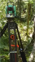
- We utilize robotic instruments and GPS for minimal land disturbance.
- Free estimates and tailored proposals for residential and commercial needs.
- Specialized in boundary clarification, subdivisions, and conservation surveys.
Services
Boundary Surveys
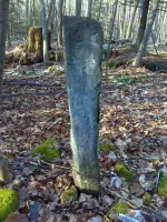
We conduct precise boundary surveys for properties ranging from under an acre to hundreds of acres. Our process identifies property lines, resolves disputes, and clarifies acreage. Using modern GPS technology, we minimize land disturbance while delivering accurate, recordable documentation for legal or development purposes.
Topographic Surveys
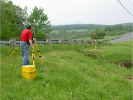
Our topographic surveys map natural and man-made features for building permits, septic design, or site planning. We capture elevation data, vegetation, and structures to create detailed site plans. This information supports architects, engineers, and landowners in development projects across Western Massachusetts.
Small Subdivisions
We specialize in Approval Not Required (ANR) subdivisions for lot creation or land swaps. Our services include field surveys, mylar drafting, and planning board presentations. We streamline the process for clients needing to divide property while meeting local regulations and ensuring clear legal documentation.
Conservation Restriction Surveys
These surveys establish protected areas for natural resource conservation. We work with landowners and agencies to define boundaries for conservation easements. Our documentation ensures compliance with state standards and supports long-term land management goals for ecological preservation.
Land Consulting
We provide expert guidance on land use, zoning compliance, and development feasibility. Our consulting services assist clients in understanding property limitations and opportunities. From initial assessments to regulatory submissions, we offer tailored solutions for residential, commercial, and conservation projects.
People
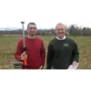
Rich Roberge
Professional Land Surveyor / Owner
Rich has 53 years of surveying experience, starting in 1970. He earned his Professional Land Surveyor license in 1989 and specializes in boundary resolution using modern technology. His expertise spans Western Massachusetts, focusing on precision and client education.
Tim Shuipis
Land Surveyor In Training
Tim began his career in 2012 and became Rich's apprentice in 2018. He obtained his LSIT certification in 2020 and is preparing for his Professional Land Surveyor license. He focuses on efficient fieldwork and project management for subdivisions and boundary surveys.
Questions
What areas do you serve?
We serve Western Massachusetts, including Hampshire, Berkshire, Franklin, and rural Hampden Counties.
What types of surveys do you offer?
We specialize in boundary surveys, topographic surveys, small subdivisions (ANRS), conservation restriction surveys, and land consulting.
How do you handle property disputes?
We use GPS and robotic instruments to accurately identify boundaries and provide documentation for legal resolution.
Can you assist with subdivision approvals?
Yes, we manage ANR subdivisions, including fieldwork, drafting, and planning board presentations.
What technology do you use?
We utilize robotic surveying instruments and survey-grade GPS equipment for precision and minimal land impact.
How do I request a quote?
Contact us via email with property details and project needs for a free, tailored proposal.