Business Details
17 Years
experience
Expert Land Surveying Services in Connecticut
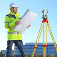
Advanced Surveying has provided professional land surveying services in Connecticut since 2009. Our team of licensed surveyors brings over 30 years of combined experience in boundary surveys, construction staking, and topographical mapping. We utilize advanced robotic technology and GPS systems to deliver precise measurements and reliable data for residential and commercial clients. Our commitment to accuracy, competitive pricing, and timely project completion ensures client satisfaction across Stamford, Westport, Norwalk, and throughout Connecticut.We maintain direct supervision of all field and office work to uphold industry standards while offering personalized service for projects of any scale. Our expertise in traditional surveying methods combined with modern tools enables efficient solutions for property line disputes, development planning, and infrastructure projects.

Services
Property Surveys
Staking Property Lines
Construction Surveying
Topographical Surveys
As-Built Surveys
Elevation Certificates
Details
- Year established: 2009
Highlights and features
- Licensed surveyors with over 30 years of combined experience
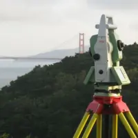
- Advanced robotic technology and GPS for precise measurements
- Accurate data guaranteed for boundary and construction surveys
- Competitive pricing with no job too large or small
- Quick turnaround times for urgent surveying needs
What people say
Most accurate services
Quick turnaround
Excellent customer service
Advanced technology used
Competent professionals
Services
Property Surveys
Our property surveys establish precise boundary lines using advanced GPS technology. Licensed surveyors conduct field measurements and office analysis to resolve disputes or prepare land for development. Clients receive detailed maps and documentation compliant with Connecticut regulations.
Construction Surveying
We provide construction layout services for residential and commercial projects. Our team marks exact building locations and elevation points to guide development. Robotic instruments ensure accuracy within millimeters for foundations, utilities, and infrastructure projects.
Topographical Surveys
Our topographic surveys capture natural and man-made features of properties. Detailed elevation data and contour maps assist architects and engineers in designing site plans. We use laser scanning to create precise 3D representations of terrain.
Elevation Certificates
We prepare FEMA-compliant elevation certificates for flood insurance requirements. Our surveys document building elevations relative to flood zones, helping property owners obtain accurate insurance rates and meet municipal regulations.
As-Built Surveys
Our as-built surveys verify completed construction matches approved plans. We document actual structures and utilities to ensure compliance with permits. These records support property transfers and future renovation projects across Connecticut.
Questions
What surveying services do you offer?
We provide property surveys, construction staking, topographical mapping, elevation certificates, and as-built surveys for residential and commercial clients in Connecticut.
Which areas do you serve?
We operate throughout Connecticut, including Stamford, Norwalk, Westport, Greenwich, and surrounding communities for all land surveying needs.
How experienced are your surveyors?
Our licensed surveyors have over 30 years of combined experience using traditional methods and advanced GPS technology for precise measurements.
What technology do you use?
We employ robotic total stations, GPS systems, and laser scanning equipment to ensure accurate data collection and efficient project completion.
How do you handle payment?
Payments process through PayPal with options for credit card payments without requiring a PayPal account. A 3.5% fee applies for online transactions.