Business Details
21 Years
experience
Trusted Surveying and Mapping Services in Jackson, NJ
Clearpoint Services has established itself as a leader in surveying and mapping solutions since 2005. Our team of licensed professionals brings over a century of combined experience to every project, leveraging cutting-edge technology to deliver precise land surveying, aerial mapping, construction layout, and subsurface utility mapping services. We serve diverse sectors including commercial infrastructure, educational campuses, and corporate parks, prioritizing accuracy and client collaboration. Our commitment to innovation ensures clients receive actionable data for informed decision-making.With a focus on efficiency and reliability, we transform complex challenges into successful outcomes. Our reputation for excellence has been built through consistent delivery of high-quality results tailored to client needs. We maintain rigorous compliance with regulatory standards while adapting to evolving industry demands. Our client-centric approach ensures personalized service from project inception to completion. This dedication to precision and partnership has made us a trusted partner for industry leaders across New Jersey and beyond.
Services
Aerial Mapping
Land Development
Title Surveys
SUE Mapping
Construction Layout
Details
- Year established: 2005
Highlights and features
- We offer 18 years of specialized geospatial engineering expertise
- Our team utilizes state-of-the-art LiDAR and drone technology
- We provide comprehensive ALTA/ACSM land title surveys
- Our subsurface utility mapping prevents construction risks
- We maintain 100% compliance with New Jersey land use regulations
What people say
Most professional survey company
Attentive customer service
Quick turnaround times
Responsive and accurate
Excellent results
Services
Aerial Mapping
Our aerial mapping service utilizes advanced drone technology with high-resolution cameras and LiDAR sensors to create detailed topographical data. This solution supports urban planning, environmental monitoring, and infrastructure development by providing accurate 3D models and orthomosaic maps. The collected data enables precise measurements and change detection over time for comprehensive project analysis.
Land Development
This service transforms raw land into functional spaces through comprehensive planning and zoning compliance. We provide boundary analysis, topographic surveys, and site design to optimize land use while meeting regulatory requirements. Our expertise ensures efficient project progression from initial concept to construction readiness across residential, commercial, and industrial developments.
Title Surveys
Our ALTA/ACSM land title surveys identify property boundaries, easements, and encroachments to support real estate transactions. These precise surveys meet industry standards for title insurance purposes and include detailed documentation of improvements, utilities, and legal descriptions to facilitate informed property decisions.
SUE Mapping
Subsurface Utility Engineering (SUE) services employ ground-penetrating radar and electromagnetic detection to map underground infrastructure. This critical service prevents utility conflicts during construction by identifying water, sewer, gas, and electrical lines. Our quality level D through A investigations follow ASCE standards to minimize project risks and costs.
Construction Layout
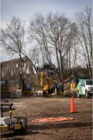
We provide precise construction layout services using robotic total stations and GPS technology to establish building corners, utilities, and site improvements. Our work ensures accurate implementation of design plans through field verification and as-built documentation, maintaining dimensional control throughout the construction process.
Questions
What geographic areas do you serve?
We primarily serve New Jersey, New York, Pennsylvania, and Delaware with specialized geospatial services for diverse projects.
How long have you been in business?
Clearpoint Services has provided surveying solutions since 2005, with over 100 combined years of professional experience.
What technologies do you use?
We employ drones, LiDAR, GPS, and robotic total stations for accurate data collection and mapping solutions.
Do you handle commercial projects?
Yes, we specialize in commercial infrastructure, industrial parks, and corporate campus developments across multiple states.
Are you licensed professionals?
Our team consists of licensed surveyors and mapping professionals with extensive industry certifications.
How quickly can you complete surveys?
Project timelines vary by scope, but we prioritize efficient delivery while maintaining rigorous accuracy standards.