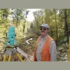
Business Details
46 Years
experience
Your Trusted Land Surveying Experts in Coventry, RI
Founded in 1980, Scituate Surveys has established itself as a leader in professional land surveying across Rhode Island. Our firm delivers boundary and topographic surveys, site planning, environmental permitting, subdivision design, and expert witness services for public and private sector clients. With over 75 combined years of experience, our principals navigate complex regulatory landscapes to secure permits and approvals while leveraging advanced technologies like GPS mapping and CAD.We serve municipalities, developers, attorneys, engineers, and lending institutions, prioritizing technical precision, client collaboration, and meticulous attention to detail. Our reputation for resolving sensitive land use challenges reflects our commitment to excellence in every project.
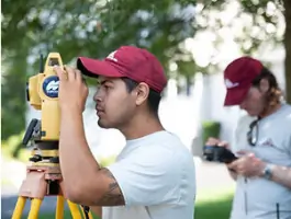


Services
Land Surveying
Land Planning
Design Services
Boundary Surveys
Easement Surveys
Utility Research
ALTA/NSPS Surveys
Flood Plain Mapping
Construction Layout
Environmental Permitting
Details
- Year established: 1980
Highlights and features
- We offer 40+ years of experience in Rhode Island land surveying and permitting.
- Our team holds specialized licenses for septic system design and soil evaluation.
- We navigate complex regulatory processes for environmental and subdivision approvals.
- We combine GPS mapping and CAD technologies with traditional surveying expertise.
- Our principals have served as expert witnesses in Rhode Island Superior Court.
Services
Land Surveying
Our licensed surveyors conduct precise boundary and topographic surveys using GPS and traditional methods. We deliver accurate data for property disputes, development projects, and legal documentation. Clients rely on our expertise in resolving complex spatial conflicts across Rhode Island's historical landscapes.
Environmental Permitting
We specialize in securing permits from agencies like CRMC and OWTS for coastal, wetland, and septic system projects. Our team navigates regulatory requirements to expedite approvals while ensuring environmental compliance. Over 30 years of experience streamlines the permitting process for clients.
Subdivision Design
We create subdivision layouts and site plans for residential, commercial, and municipal projects. Services include freshwater wetland permitting, soil evaluation, and FEMA flood certification. Our designs balance regulatory compliance with practical development needs using advanced CAD tools.
Construction Layout
Our construction layout services ensure accurate implementation of site plans for new buildings, additions, and infrastructure. We use GPS and photogrammetry to map existing conditions and guide grading, utilities, and structural placement with millimeter precision.
Expert Witness Services
We provide expert testimony in court cases and municipal hearings regarding boundary disputes and land use issues. Our principals have decades of experience presenting technical evidence clearly to legal and regulatory bodies across Rhode Island.
People
Angelo Mike Raimondi
Founder & President
A licensed land surveyor with 30+ years of experience, Mike founded Scituate Surveys in 1980. He specializes in environmental permitting and septic system design, combining engineering expertise with regulatory navigation skills.
Julie M. Raimondi
President
A Rhode Island Professional Land Surveyor since 2015, Julie oversees design and operations. She focuses on solving complex geographical puzzles through boundary research, subdivision planning, and environmental compliance solutions.
Kerri Rice
Business Manager
With 30+ years at the firm, Kerri manages business operations and expedites permit submissions. Her institutional knowledge ensures smooth project coordination between clients and regulatory agencies.
Brian Jannarelli
Party Chief
Brian leads field teams in conducting boundary surveys and topographic mapping. His expertise ensures accurate data collection for residential, commercial, and municipal projects across Rhode Island.
Salvador Martinez
Field Technician
Salvador supports survey crews with field data collection and equipment operation. He assists in utility research and GPS mapping to deliver precise spatial information for client projects.
Questions
What surveying services do you offer?
We provide boundary surveys, topographic mapping, subdivision design, environmental permitting, construction layout, ALTA/NSPS surveys, and expert witness services for land use disputes.
Do you handle regulatory permitting for land development?
Yes, we secure permits from agencies like CRMC, OWTS, and local municipalities for septic systems, wetlands, and coastal resources, leveraging 40+ years of regulatory expertise.
How experienced is your team?
Our principals have 75+ combined years of experience. Founding surveyors hold specialized licenses for soil evaluation and septic design, with expertise in Rhode Island's unique land use challenges.
Can you assist with construction project layouts?
Yes, we provide GPS-guided construction layout services for buildings, utilities, and infrastructure, ensuring precise implementation of approved site plans.
What geographic areas do you serve?
We operate statewide in Rhode Island, with extensive experience in coastal, wetland, and historical land use projects across the region's diverse terrain.