Business Details
24 Years
experience
Professional Land Surveying Services in Springvale, ME
LinePro Land Surveying has been delivering precise land surveying solutions in Southern Maine since 2002. Our team of licensed professionals specializes in boundary surveys, ALTA/NSPS standards compliance, FEMA flood certifications, and advanced GPS mapping technologies. With decades of combined experience, we serve residential clients, commercial developers, and forestry professionals across York and Cumberland counties. Our expertise in deed research, construction layout, and waterfront permitting ensures projects meet regulatory requirements efficiently.We maintain rigorous quality control through real-time kinematic GPS systems and traditional surveying methods. Our founder, Joseph L. Stanley, holds a degree in Spatial Information Engineering from the University of Maine and brings over 20 years of field experience. We prioritize client education through detailed documentation and transparent communication throughout every project phase. Our commitment to technical excellence has established us as a trusted partner for property developers and municipalities throughout Maine.
Services
Boundary Surveys
ALTA Land Title Surveys
Construction Layout
GPS Mapping
FEMA Flood Certificates
Lot Divisions
Waterfront Permitting
Details
- Year established: 2002
Highlights and features
- Licensed surveyors with 20+ years of Maine-specific experience
- RTK GPS technology for centimeter-level accuracy in fieldwork
- ALTA/NSPS-certified survey documentation for commercial properties
- Specialized expertise in waterfront permitting and regulatory compliance
- Comprehensive deed research and boundary dispute resolution services
Services
Boundary Surveys
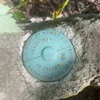
Our boundary surveys establish precise property lines using traditional methods and RTK GPS technology. We analyze historical deeds and records to resolve disputes and prepare documentation for new fence installations or property sales. This service meets Maine state standards for legal property descriptions.
ALTA Land Title Surveys
We conduct ALTA/NSPS-compliant surveys for commercial properties that identify easements, improvements, and boundary encroachments. These detailed assessments satisfy lender requirements and include zoning compliance verification. Our surveys incorporate municipal records and utility location data for comprehensive property analysis.
Construction Layout
Our construction layout services ensure building projects adhere to approved plans using total station instruments and GPS systems. We verify foundation placements, utility locations, and grading specifications throughout project phases. This service maintains alignment with local permitting requirements for residential and commercial developments.
GPS Mapping
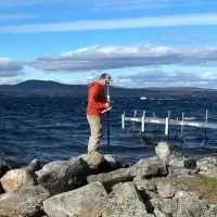
We utilize real-time kinematic GPS systems for large-scale mapping projects requiring centimeter-level accuracy. This technology enables efficient topographic surveys and boundary assessments across extensive properties. Our digital mapping services support forestry management and land development planning.
FEMA Flood Certificates
Our FEMA-certified elevation certificates determine flood zone classifications for insurance purposes. We measure building elevations relative to floodplains and submit documentation to the National Flood Services database. This service helps property owners secure accurate flood insurance rates.
People
Joseph L. Stanley
Maine Professional Land Surveyor
Licensed since 2002 with expertise in boundary disputes, FEMA flood surveys, and RTK GPS applications. Holds a Spatial Information Engineering degree from the University of Maine at Orono and oversees all Maine operations.
Luke Lapierre
Licensed Surveyor in Training
Surveyor in Training supporting field operations and data analysis. Assists with boundary research, construction layout, and digital mapping projects under senior supervision.
Questions
What geographic areas do you serve?
We primarily serve Southern Maine, including York County and Cumberland County, with specialized expertise in coastal and inland waterway properties.
What survey types do you specialize in?
Our specialties include boundary surveys, ALTA/NSPS title surveys, FEMA flood certifications, construction layout, and GPS mapping for residential and commercial properties.
How do you handle property disputes?
We conduct detailed deed research, historical record analysis, and field measurements to establish accurate boundary determinations that meet legal standards.
What technology do you use?
We combine traditional surveying methods with RTK GPS systems for centimeter-level accuracy in boundary assessments and large-scale mapping projects.
How long does a typical survey take?
Most residential boundary surveys complete within 1-2 days, while commercial ALTA surveys typically require 3-5 business days depending on property complexity.