Business Details
8 Years
experience
Your Trusted Land Surveying Experts in Warsaw, NY
J.A.Tiede PLS has been serving clients in Warsaw, NY since 2018, combining traditional land surveying expertise with cutting-edge drone technology. Our FAA-certified UAV pilots deliver aerial photography and 3D mapping solutions alongside standard surveying services like boundary and topographic surveys. We prioritize affordability without compromising precision, offering ALTA surveys, FEMA elevation certificates, and customized mapping solutions. With decades of combined experience in land measurement and aerial data collection, our team provides actionable insights for property owners, developers, and insurance professionals.We maintain rigorous quality control standards while leveraging modern technology to enhance deliverables. Our commitment to innovation is matched by our dedication to client education and transparent communication throughout every project. Located at 36 Rochester Street, we serve local and regional clients requiring accurate spatial data and visual documentation.


Services
Aerial Photography
Land Surveying
3D Mapping
Boundary Surveys
Topographic Surveys
ALTA Surveys
FEMA Certificates
Details
- Year established: 2018
Highlights and features
- We offer FAA-certified UAV drone operations for aerial documentation
- Our team provides standard surveying services at competitive pricing
- We combine traditional surveying methods with modern 3D mapping technology
- We specialize in FEMA elevation certificates for flood insurance requirements
- Our local expertise serves Warsaw, NY and surrounding regions
Services
Aerial Photography
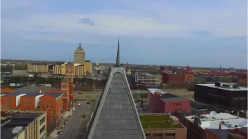
Our FAA-certified pilots capture high-resolution aerial photographs and video from elevations up to 400 feet. This technology provides unique property perspectives for real estate marketing, insurance documentation, and infrastructure assessment. Clients receive digital media files suitable for presentations, reports, and online listings.
Land Surveying
We conduct traditional land surveying services including boundary determination, topographic mapping, and construction staking. Our licensed surveyors use precision instruments to create official property records for legal documents, development projects, and land transactions in compliance with New York State standards.
3D Mapping
Using drone-collected data combined with GPS ground control points, we generate detailed 3D models of properties and structures. These digital models support planning, design, and visualization for construction projects, environmental assessments, and property management applications using the latest geospatial software technology.
Boundary Surveys
Our boundary surveys establish legal property lines through historical record research and field measurements. This service identifies easements, encroachments, and parcel dimensions for real estate transactions, fence installations, and land development projects with official documentation for title insurance purposes.
FEMA Certificates
We provide FEMA elevation certificates documenting building elevations relative to flood risk zones. These official forms support flood insurance requirements, community rating system discounts, and compliance with local building codes for properties in Warsaw and surrounding areas.
People
Jeff Tiede
Owner / Licensed Land Surveyor
Jeff Tiede is a New York State Licensed Professional Land Surveyor and FAA-certified drone pilot with over 15 years of experience in land measurement and geospatial data collection. He established J.A.Tiede PLS in 2018 to combine traditional surveying expertise with modern UAV technology for improved client deliverables.
Questions
What surveying services do you offer?
We provide boundary surveys, topographic surveys, ALTA surveys, FEMA elevation certificates, and 3D mapping using drone technology for residential and commercial properties.
Do you provide aerial photography services?
Yes, our FAA-certified UAV pilots capture aerial photographs and video up to 400 feet elevation for property documentation and real estate marketing.
What areas do you serve?
We primarily serve Warsaw, NY and surrounding regions, with mobile surveying teams available for projects throughout Western New York.
How much do your services cost?
Basic land surveying starts at $1, aerial photography packages begin at $199, and 3D mapping services require a $1 initiation fee with final pricing based on project scope.
Are you licensed and insured?
We maintain New York State Professional Land Surveyor licensing and FAA Part 107 certification for commercial drone operations with full liability insurance coverage.