Business Details
27 Years
experience
Your Trusted Surveying Partner in Brookville, PA
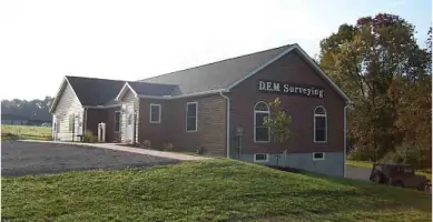
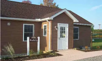
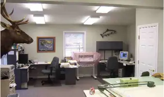
Established in 1999, DEM Surveying has built a reputation for delivering precise and reliable professional surveying services across Pennsylvania. Our team, led by founder Daniel E. Moore, PLS, combines decades of industry experience with cutting-edge technology to execute projects ranging from boundary surveys to GPS mapping. Certified as a HUBZone small business since 2006, we prioritize compliance with federal standards and maintain Professional Liability Insurance to ensure client confidence. Our Brookville office, strategically located near Interstate 80, houses advanced AutoCAD systems and GPS equipment, enabling efficient project completion. Staff members regularly participate in continuing education and hold certifications like EPA 40-Hour Hazardous Training, ensuring readiness for complex sites.We serve commercial, governmental, and private clients with tailored solutions, emphasizing accuracy and adherence to regulatory requirements. Our fleet of four-wheel-drive vehicles, ATVs, and hydrographic tools supports operations in diverse terrains. Client-centric workflows include digital deliverables and color plotting, reflecting our commitment to modern, accessible results. Community engagement through organizations like the Brookville Area Chamber of Commerce underscores our dedication to local partnerships. As we continue growing, our mission remains focused on technical excellence and client satisfaction.
Services
Boundary Surveys
ALTA-ACSM Surveys
Topographic Surveys
Construction Stake-Out
GPS Mapping
Volumetric Surveys
Hazardous Site Surveys
Pipeline Surveys
AutoCAD Mapping
Erosion Control Plans
Details
- Year established: 1999
Highlights and features
- We offer 20+ years of specialized surveying expertise.
- Our HUBZone certification demonstrates federal contracting compliance.
- We utilize GPS systems with sub-centimeter accuracy.
- Our staff holds EPA 40-hour hazardous site certifications.
- We maintain Professional Liability Insurance for client protection.
Associations and certifications
- HUBZone
Services
Boundary Surveys
Our boundary surveys precisely define property lines using advanced Total Stations and GPS technology. We analyze historical records and physical markers to resolve disputes and support real estate transactions. Clients receive detailed maps compliant with state and federal standards.
Topographic Surveys
Topographic surveys capture terrain features and elevations for construction and environmental projects. We employ GPS and digital elevation modeling to create accurate 3D representations. Deliverables include contour maps and digital files for engineering analysis.
Construction Stake-Out
We provide precise stake-out services for infrastructure and building projects using robotic total stations. Our team marks critical points for foundations, utilities, and grading to ensure construction alignment. As-built surveys verify completed work against plans.
GPS Mapping
Our GPS mapping solutions combine Trimble systems with GIS software for asset management and spatial analysis. Surveys achieve 0.5 cm accuracy for applications like pipeline monitoring and land development. Data is delivered in AutoCAD and GIS-compatible formats.
Hazardous Site Surveys
Certified personnel conduct surveys on hazardous sites following EPA 40-hour training protocols. We use non-invasive techniques and protective equipment to map contaminated areas while complying with OSHA and DOT regulations for client safety.
People
Daniel E. Moore
Founder / Professional Land Surveyor
Daniel E. Moore, PLS, established DEM Surveying in 1999 after earning his professional license. With expertise in boundary law and hazardous site protocols, he oversees project quality and client relations. His leadership emphasizes technical precision and community engagement.
Steven T. Korchak
Surveyor
Steven T. Korchak contributes to field operations and data analysis at DEM Surveying. Certified in hazardous safety standards, he specializes in GPS systems and construction stake-out projects. His work supports infrastructure development across western Pennsylvania.
Questions
What geographic areas do you serve?
We provide surveying services throughout Pennsylvania, with a focus on western Pennsylvania within a 1.5-hour radius of Brookville.
Are you certified for federal contracts?
Yes, we've been a certified HUBZone small business since 2009, meeting federal contracting requirements for disadvantaged areas.
What technologies do you use?
We utilize Trimble GPS systems with sub-centimeter accuracy, robotic total stations, AutoCAD mapping software, and digital elevation modeling tools.
Do you handle hazardous site surveys?
Our team holds EPA 40-hour hazardous training certification and follows OSHA protocols for surveys on contaminated or Superfund sites.
What deliverables can I expect?
Clients receive color-plotted maps, digital files (CAD/GIS formats), and detailed reports. Data collectors ensure accurate field-to-office workflow.
How do you ensure project accuracy?
We combine traditional survey methods with GPS technology and maintain Professional Liability Insurance to guarantee precise, verifiable results.