At Allen Geomatics, we are a land surveying services and consulting firm that has a strong foundation in the surveying industry. Honesty and Integrity seem to have become clich terms, but they sincerely are at the root of every action taken at this company. It is our desire to provide proactive communication and follow through on commitments. The latest robotic technology, GPS, and surveying software is utilized to perform surveying services. We also take great pride in making sure we pay close attention to the details that require extra care.
At Allen Geomatics, we strive to provide the best service for our clients, and we do this by never cutting corners and ensuring a commitment to a job done right the first time. Whether you are a general contractor in need of construction staking services or a residential client in need of an elevation certificate, we offer the services you require backed by honesty and integrity. We began our operations over a decade ago and have seen steady growth over the years. While our operations started with one employee, the owner and founder, Jeff Allen, we currently have four other technically skilled employees at our firm.
The American Land Title Association and the National Society of Professional Land Surveyors developed a national standard to which all surveyors must adhere, regardless of the standards of practice of the state in which they are licensed. This always includes a comprehensive title report, which would expose all recorded easements affecting the property. At Allen Geomatics, our team is very familiar with these standards and will be in close communication with the real estate attorney and title insurance agent to ensure a complete and timely product is delivered.
Through years of experience providing topographic design data to civil engineers and other development professionals, our team at Allen Geomatics has acquired a keen sense of the data and product the end user needs to supplement their area of expertise. We use AutoCAD and tie most projects to the NC Grid and NAVD88 datum, which allows the finished product to be easily merged with other GIS databases. Our land surveys are highly varied and can be used for many different purposes, depending on the scope of your project and its specific requirements.
Kale Engineering has lost or had stolen a Spectra Precision Nomad 1050 data collector on Wednesday 01/13/ 21. It was last seen at 2329 Dunbar Street in Winston Salem at 4:45 pm. The serial number is VS0QC04312. (The 0's are numbers not letters.) We can be contacted at 336-768-0250 or kaleengr@...
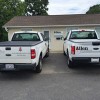
Well ... today marks 10 years at Allen Geomatics, P.C.. and I have to say it has been a great ride. When I started it was Jeff and I and 1 other guy in 1 small office and 1 truck. We have grown not only as a business but as a family (weddings, babies etc ...). Now there are 7 employees and we fill the entire building, a parking lot full of trucks and could use more of both. Like I said, it's been a great ride and I can't wait to see what the next 10 years brings. Love my job and love my guys!...
Bermuda Run, NC We’ve performed several surveys for Elevation Certificates for folks needing flood insurance. This flood event confirms what the models show as a 1% annual chance (formerly referred to as 100-yr flood). This recent flood didn’t quite come up as high as the 1% line. If anyone has a...
Just a reminder as to why it is so important to make sure you know where your property corners. Have your land surveyed before you make a mistake that costs more than a survey.
Drone test flight 07/22/20. Jeff Allen, Brandon Simpson
Similar Businesses