Business Details
30 Years
experience
Professional Land Surveying Services in Beulaville, NC
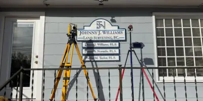
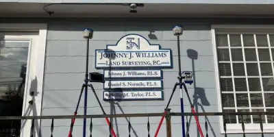
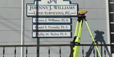
Established in 1996 by Johnny J. Williams, our land surveying firm operates on principles of quality, timeliness, and fair pricing. With a team of experienced professionals, including three licensed surveyors with 91 combined years of expertise, we serve southeastern North Carolina counties. Our services span boundary surveys, topographic mapping, GPS data collection, ALTA surveys, and drone-assisted projects. We maintain low employee turnover, with seven full-time staff having at least a decade of service. Our equipment includes GPS units, robotic total stations, and a DJI Inspire drone for precision work.We serve government agencies, developers, and individual property owners across a 7-county region. Our 2,300-square-foot office in Beulaville houses advanced drafting software and computing systems. We prioritize client satisfaction through experienced personnel, modern technology, and adherence to founding principles. Our commitment to quality remains unchanged since our inception, ensuring reliable service for all surveying needs.
Services
Boundary Surveys
GPS Surveys
Elevation Certificates
Topographic Surveys
ALTA Surveys
Subdivision Design
Drone Surveying
Details
- Year established: 1996
Highlights and features
- We offer 91 years of combined experience in land surveying
- Our team includes three licensed surveyors with 62 combined licensing years
- We maintain low employee turnover with experienced staff
- We utilize advanced equipment including GPS units and drones
- We serve seven North Carolina counties with local expertise
Services
Boundary Surveys
We conduct boundary surveys for land tracts ranging from small parcels to thousand-acre properties. These surveys identify property lines, easements, and improvements for land transfers, subdivisions, and dispute resolution. Our work meets legal requirements for title insurance and loan closings across eastern North Carolina.
GPS Surveys
Our three survey-grade GPS systems establish precise coordinates tied to North Carolina's grid system. This technology enables integration with mapping platforms like Google Earth while providing elevation data for flood zone analysis. We maintain accuracy through regular equipment calibration and quality control checks.
Topographic Surveys
We create detailed topographic maps showing ground elevations, contours, and utility locations. These surveys support infrastructure design, drainage planning, and development projects. Our field crews use robotic total stations and GPS units to capture precise terrain data for developers and engineers.
ALTA Surveys
We perform ALTA/ACSM standard surveys that include title exceptions and meet lender requirements. These comprehensive surveys identify encroachments, easements, and improvements for commercial properties. Our team follows national standards for shopping centers, industrial sites, and other major developments.
Drone Surveying
Our DJI Inspire drone captures high-resolution aerial imagery for large-scale projects. This technology enhances data collection for topographic surveys, ALTA surveys, and site documentation. We provide digital 4K video and large-format printed images for property owners and developers.
People
Johnny J. Williams
Owner/Operator
Licensed surveyor with 35+ years of experience. Founded the company in 1996 after working with Quadrant Surveying. Holds Associates Degree in Land Surveying from Coastal Carolina Community College. Manages daily operations while maintaining field survey responsibilities.
Phillip M. Taylor
Survey Manager
Licensed surveyor since 1997 with 25+ years of experience. Manages survey crews and projects. Holds Associates Degree in Land Surveying and Bachelor of Science in Business Administration. Member of North Carolina Society of Surveyors and Coastal Chapter.
Daniel S. Normile
Consultant
Licensed surveyor with 30+ years of experience. Former crew chief managing up to seven survey teams. Specializes in complex topographic surveys and large construction projects. Now provides consulting services while remaining active in professional organizations.
Questions
What surveying services do you offer?
We provide boundary surveys, topographic mapping, GPS control surveys, ALTA/ACSM surveys, elevation certificates, subdivision design, and drone-assisted surveying for residential, commercial, and government clients.
Which areas do you serve?
We primarily serve Duplin, Onslow, Lenoir, Jones, Pender, New Hanover, and Sampson Counties in southeastern North Carolina, with additional coverage throughout the region.
What equipment do you use?
Our equipment includes three GPS mapping units, robotic total stations, conventional total stations, a DJI Inspire drone, and six data collectors for precise field measurements.
How experienced is your team?
Our three licensed surveyors have 91 combined years of experience, with 62 years of active licensure. Field crews include staff with 10+ years of service and specialized training in surveying technologies.
Can you handle large-scale projects?
Yes, our team manages complex surveys for subdivisions, commercial developments, and infrastructure projects using advanced equipment and experienced personnel to meet project deadlines.
Do you offer aerial mapping services?
We provide drone-assisted surveying and aerial photography with 4K video capabilities for site documentation, topographic analysis, and property visualization needs.