Business Details
Emergency
services
Your Trusted Partner for Geospatial Data Solutions
At SAM, we deliver fast, accurate geospatial data to empower clients with actionable insights for infrastructure success. Our expertise spans mapping, data collection, inspection, and digital solutions, supporting projects from local surveys to multibillion-dollar initiatives. With advanced technologies like LiDAR, GIS, and BIM, we provide foundational data for utilities, transportation, government, and natural resource sectors. Our national reach combines with local teams deployable within 24 hours, ensuring precision and efficiency. Recognized as a top workplace for culture and innovation, we prioritize collaboration, inclusion, and technological advancement.Our 13 consecutive years on ENRs Top 500 Design Firms list reflect our commitment to excellence. From subsurface utility engineering to powerline inspections, we transform raw data into strategic assets. Our acquisitions, like Doucet Survey, expand our capabilities while maintaining rigorous safety and compliance standards. Clients benefit from tailored solutions, including substation digital twins and stormwater mapping, addressing both current needs and future challenges. With offices in Houston, Charlotte, and Melville, we serve diverse industries while fostering professional growth and community impact.

Services
Land Surveying
Aerial Mapping
GIS Consulting
BIM/3D Laser Scanning
Subsurface Utility Engineering
Highlights and features
- We offer 13 consecutive years of recognition in ENRs Top 500 Design Firms.
- Our teams deploy within 24 hours for urgent geospatial data collection.
- We utilize cutting-edge technologies like LiDAR and BIM for precise insights.
- Our national reach combines with local expertise in key U.S. regions.
- We prioritize a culture of inclusion, innovation, and employee engagement.
Services
Land Surveying
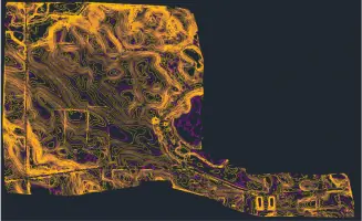
Our land surveying services utilize state-of-the-art equipment to deliver precise measurements for infrastructure projects. We support route planning, boundary determination, and construction monitoring. Clients receive accurate data to inform engineering and development decisions.
Aerial Mapping
Aerial mapping employs LiDAR and high-resolution imagery for rapid data capture across large areas. This technology aids in topographic analysis, asset management, and project planning. Clients benefit from faster turnaround and reduced field time.
GIS Consulting
GIS consulting services help clients visualize and analyze geospatial data for informed decision-making. We develop custom solutions for utilities, transportation networks, and environmental management. Our expertise includes substation digital twins and public safety mapping.
BIM/3D Laser Scanning
BIM and 3D laser scanning create detailed digital replicas of physical assets. These models support construction validation, facility management, and retrofit planning. Clients gain enhanced accuracy for complex infrastructure projects.
Subsurface Utility Engineering
Subsurface utility engineering identifies and maps underground infrastructure to prevent damage during construction. We employ ground-penetrating radar and vacuum excavation. Clients reduce risks and ensure compliance with safety standards.
People
Matthew Reinhart, P.E.
Mid-East Director of Transportation
Matthew Reinhart leads transportation initiatives with expertise in infrastructure planning and project management. His engineering background ensures strategic solutions for complex transportation networks across the Mid-East region.
Questions
What industries does SAM serve?
We support utilities, transportation, government agencies, and natural resource sectors with geospatial data solutions.
How quickly can SAM deploy teams for projects?
Our teams deploy within 24 hours to begin data collection nationwide.
What technologies does SAM use?
We utilize LiDAR, GIS, BIM, and aerial drones for precise data capture and analysis.
Does SAM handle large-scale infrastructure projects?
Yes, we manage projects ranging from local surveys to multibillion-dollar developments.
Is SAM recognized for workplace culture?
We’ve earned Top Workplace awards in Houston, Charlotte, and Long Island for our collaborative environment.
How does SAM ensure data accuracy?
Advanced technologies and rigorous quality control processes guarantee precise, reliable geospatial insights.