
Business Details
16 Years
experience
Professional Land Surveying Services in Richmond, VA
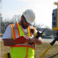
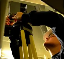
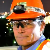
Nyfeler Associates is a professional land surveying firm dedicated to delivering precision and expertise in survey support services. Since 2010, we have leveraged advanced technology, including robotic instruments, RTK-GPS equipment, and Civ3D CAD software, to serve government and private clients across Virginia, Washington, D.C., Oregon, and international locations. Our team holds security clearances from agencies like the CIA, NASA, and U.S. Capitol Police, enabling access to high-security projects. With decades of combined experience, our professionals have completed complex assignments such as hydroelectric dam layouts, Antarctic building expansions, and topographic surveys for military facilities. We prioritize innovation, accuracy, and client satisfaction, maintaining strong ties to the U.S. military and engineering communities.Our leadership includes experts with 36 years of field experience and specialized training in construction layout and hydrographic surveys. We are committed to advancing industry standards through cutting-edge methodologies and a deep understanding of client needs.
Services
Land Surveying
Construction Support
Topographic Surveys
Boundary Surveys
3D Laser Scanning
Details
- Year established: 2010
Highlights and features
- We utilize robotic instruments and RTK-GPS for high-accuracy surveys.
- Our team holds security clearances for sensitive government projects.
- 36 years of combined field experience in complex survey environments.
- Completed projects across Antarctica, military bases, and urban centers.
- Pioneered boat-mounted sonar fathometer use for hydrographic surveys.
Services
Land Surveying
We conduct precise land surveys using robotic instruments and RTK-GPS for boundary determination, construction layout, and legal documentation. Our expertise ensures compliance with local regulations and project-specific requirements. Clients rely on our data for infrastructure development and property disputes.
Construction Support
Our construction support includes high-accuracy layout for buildings, roads, and utilities using advanced tools like Civ3D software. We ensure projects meet design specifications and timelines. Clients benefit from reduced rework and cost savings through our precise measurements.
Topographic Surveys
We create detailed topographic maps for site planning and engineering design. Our surveys capture elevation data, natural features, and man-made structures. Clients use these maps for drainage analysis, environmental assessments, and development permits.
Boundary Surveys
We establish legal property boundaries using historical records and field measurements. Our surveys resolve disputes and support real estate transactions. Clients receive certified documentation for title insurance and land development.
3D Laser Scanning
We use laser scanning to create high-resolution 3D models of structures and landscapes. This technology supports preservation projects, structural analysis, and construction planning. Clients gain accurate digital replicas for design and monitoring purposes.
People
George Nyfeler
President and Land Surveyor
With 36 years of experience, George leads Nyfeler Associates, specializing in land surveying and construction layout. He manages complex projects and mentors staff, leveraging his military background and technical expertise.
James Ryan West
Senior Project Manager
James oversees projects using AutoCAD Civ3D and field equipment. He specializes in high-accuracy surveys for military and infrastructure projects, ensuring timely delivery and client satisfaction.
Karen Hubbard
Survey Project Manager
Karen manages boundary and topographic surveys with expertise in construction layout. She contributes to 3D laser scanning projects and brings precision to field and office operations.
Questions
What services does Nyfeler Associates offer?
We specialize in land surveying, construction support, topographic surveys, boundary surveys, and 3D laser scanning for government and private clients.
Which industries do you serve?
We work with government agencies, military facilities, engineering firms, and private clients on infrastructure and construction projects.
Do you handle international projects?
Yes, we’ve completed work in Antarctica, including building layout services for McMurdo Station expansions.
What technology do you use?
We employ robotic instruments, RTK-GPS equipment, Civ3D CAD software, and laser scanning for precision surveys.
Are you qualified for high-security projects?
Our team holds security clearances from agencies like the CIA, NASA, and U.S. Capitol Police for sensitive site access.