Business Details
21 Years
experience
Trusted Geospatial Surveyors in Asheville, NC
Ed Holmes & Associates Land Surveyors has been a trusted leader in geospatial services since 2005, delivering precise land surveying and spatial data solutions across the Southeastern United States. Our team combines advanced technologies like 3D laser scanning, UAS drones, and GIS mapping with decades of collective expertise to support construction, infrastructure, and environmental projects. We specialize in boundary surveys, subsurface utility investigations, and reality capture, ensuring clients receive accurate data for informed decision-making.With offices in North Carolina and South Carolina, we maintain deep regional knowledge of local regulations and terrain. Our commitment to innovation and quality has earned recognition, including the Asheville Chamber of Commerce Sky High Growth Award. We prioritize client collaboration, offering tailored solutions that align with project-specific needs while upholding the legacy of our founder, Ed Holmes. Our services empower industries ranging from real estate to urban planning with reliable geospatial insights.

Services
Geomatics
Construction Surveying
GIS Mapping
Remote Sensing
Subsurface Utility Investigation
Details
- Year established: 2005
Highlights and features
- We offer 20+ years of combined experience in geospatial data collection and analysis.
- Our team utilizes advanced technologies like 3D laser scanning and UAS drones.
- We provide region-specific expertise with deep knowledge of Southeastern regulations.
- Our services ensure precise boundary assessments and subsurface utility mapping.
- We maintain a client-focused approach with dedicated project collaboration.
Services
Geomatics
Our geomatics services include boundary surveys, topographic mapping, and ALTA/land title surveys. We use traditional techniques and advanced tools to ensure precise spatial data for construction and land development. Our team delivers accurate measurements to support legal, engineering, and planning needs.
Construction Surveying
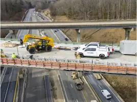
We provide construction staking, 3D modeling, and as-built surveys to ensure projects align with design specifications. Our services include machine control setup and settlement monitoring, guaranteeing structural accuracy from foundation to completion using high-precision instruments.
GIS Mapping
Our GIS services create interactive maps and spatial analyses for infrastructure management and site selection. We design geodatabases and web-based dashboards to help clients visualize and utilize geographic data for decision-making in urban planning and environmental projects.
Remote Sensing
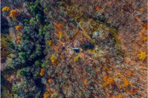
Using drones, LiDAR, and photogrammetry, we capture detailed 3D models of terrain and structures. This technology enables efficient progress documentation, terrain analysis, and structural inspections without direct contact, enhancing project safety and accuracy.
Subsurface Utility Investigation
We employ ground-penetrating radar and electromagnetic tools to map underground utilities like gas lines and irrigation systems. Our services identify public and private utilities to prevent damage during excavation, ensuring compliance with safety regulations and project timelines.
People
Joshua E. Holmes
President
Joshua E. Holmes leads Ed Holmes & Associates Land Surveyors with a focus on innovation and client collaboration. He oversees strategic growth while maintaining the company's commitment to precision and quality in geospatial services.
Jason N. Gasperson
Director of Business Development
Jason N. Gasperson drives business growth and client relationships at Ed Holmes & Associates Land Surveyors. He connects clients with tailored surveying solutions, leveraging his industry expertise to expand the company's regional impact.
J. Dallas Gordon
Geomatics Team Leader
J. Dallas Gordon manages geomatics operations, ensuring accurate boundary surveys and topographic assessments. His technical expertise and attention to detail support clients in land development and infrastructure projects.
Logan Woodie
Construction Team Lead
Logan Woodie leads construction surveying efforts, specializing in 3D modeling and machine control. He ensures projects adhere to design specifications through precise layout and progress monitoring.
Daniel Hill
Remote Sensing Team Leader
Daniel Hill directs remote sensing operations, utilizing drones and LiDAR for high-resolution data collection. His work supports complex projects requiring aerial and terrestrial reality capture solutions.
Questions
What services does Holmes Geospatial offer?
We provide geomatics, construction surveying, GIS mapping, remote sensing, and subsurface utility investigations using advanced technologies like 3D scanning and drones.
Which regions do you serve?
We operate across North Carolina, South Carolina, Tennessee, and surrounding areas with localized regulatory and terrain expertise.
What technologies do you use?
Our tools include UAS drones, 3D laser scanners, SLAM, photogrammetry, and GIS platforms for accurate data collection and analysis.
How long has your team been in business?
Our team has over 20 years of combined experience, with the company founded in 2005 as Ed Holmes & Associates.
Can you handle complex infrastructure projects?
Yes, we specialize in challenging projects requiring precise boundary surveys, utility mapping, and reality capture for construction and development.