Business Details
Professional Land Surveying Services in Jenkinsville, SC
At Glenn Associates Surveying, we have built a reputation for professionalism through decades of consistent effort to deliver quality service. Our team is dedicated to advancing our expertise in land surveying, utilizing cutting-edge technology to exceed client expectations. We specialize in boundary, topographic, hydrographic, and construction surveys, serving private and commercial clients across diverse industries. Our work is guided by direct supervision from licensed Professional Surveyors, ensuring precision and adherence to industry standards.With over 40 years of experience leveraging the SC State Plane Coordinate System, we maintain ties to NGS Monumentation for accuracy. Recognized through numerous awards from professional societies, our commitment to innovation and client satisfaction remains unwavering. We operate under a philosophy that prioritizes service over profit, upholding ethical standards and continuous improvement to maintain our trusted reputation.

Services
Land Surveys
Boundary Surveys
Topographic Surveys
Hydrographic Surveys
3D Laser Scanning
Pipeline Surveys
Aerial Control
GIS Mapping
Deformation Studies
Subdivision Design
Highlights and features
- We utilize the latest GNSS and 3D laser scanning technology for precise results.
- Our projects are supervised directly by licensed Professional Surveyors.
- Recognized with multiple awards from state and national surveying societies.
- Over 40 years of experience working with the SC State Plane Coordinate System.
- Comprehensive expertise in industrial, utility, and environmental surveying projects.
Services
Land Surveys
Our land surveys provide precise measurements for property boundaries, subdivisions, and development projects. Using advanced GNSS technology and robotic total stations, we ensure accuracy for residential, commercial, and industrial clients. Our team adheres to state and federal standards, delivering reliable data for legal documentation and construction planning.
Hydrographic Surveys
Hydrographic surveys map underwater terrain for lakes, rivers, and coastal areas. We employ sonar technology and specialized equipment to measure depths, contours, and volumes. These surveys support dredging projects, environmental assessments, and infrastructure development near water bodies, ensuring data accuracy for engineering and regulatory compliance.
3D Laser Scanning
3D laser scanning captures detailed topographic data for complex structures and landscapes. Our high-definition scanners produce precise point clouds used in heritage preservation, infrastructure analysis, and construction monitoring. This technology enables efficient data collection with minimal field time, reducing project costs and timelines.
Pipeline Surveys
Pipeline surveys ensure accurate alignment and documentation for oil, gas, and utility infrastructure. We conduct route surveys, as-built mapping, and staking services to support installation and maintenance. Our work complies with industry regulations, providing critical data for pipeline safety, environmental impact assessments, and operational efficiency.
Topographic Surveys
Topographic surveys detail natural and man-made features of a property, including elevations and contours. We use total stations and GPS to create detailed maps for development, zoning, and environmental studies. These surveys form the foundation for engineering designs, land use planning, and construction projects.
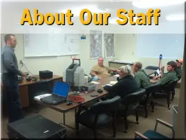
People
Michael R. Mills, Sr.
President
With a 1976 B.S. in Forest Management from Clemson University, Michael leads the firm's strategic direction. He oversees major projects and maintains professional standards, ensuring client satisfaction through decades of industry experience.
Mark E. Mills
Vice-President
As Vice-President, Mark manages operational workflows and technical oversight. His Clemson University education and extensive field experience contribute to the company's commitment to precision and innovation in surveying practices.
Brian B. Bonds
Project Manager
Brian coordinates erosion control and surveying projects, leveraging certifications in safety training and geospatial analysis. His expertise in field operations and client communication ensures project success across diverse environments.
John Mark Mills
Site Surveyor
A FAA-certified drone operator, John specializes in aerial data collection and boundary surveys. His Clemson University degree in Environmental Management supports advanced techniques in land documentation and analysis.
R. Jarrod Mills
Site Surveyor
Jarrod conducts field surveys and data analysis, applying his wildlife biology background to environmental projects. His technical skills in GPS and total station equipment ensure accurate results for complex land assessments.
Questions
What types of surveying services do you offer?
We provide land, boundary, topographic, hydrographic, pipeline, and 3D laser scanning services for commercial, industrial, and environmental projects.
Do you serve areas outside South Carolina?
While based in South Carolina, our expertise extends to regional projects requiring specialized surveying for utilities, infrastructure, and natural resource management.
What technology do you use for surveys?
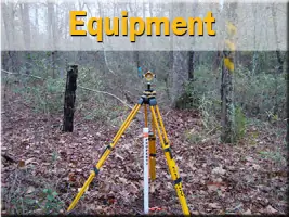
We employ GNSS, robotic total stations, 3D laser scanners, and hydrographic sonar equipment to ensure precision and efficiency in data collection.
Are your surveyors licensed professionals?
Yes, all projects are supervised by licensed Professional Surveyors with decades of combined experience in the field.
How can I request a surveying quote?
Contact us via phone or email to discuss project details and receive a customized proposal based on your specific needs.