Business Details
43 Years
experience
Trusted Surveying & Mapping Services in Jacksonville, FL
Clary & Associates was founded in 1983 to provide professional geomatics, surveying, and mapping services throughout North Florida. With over 42 years of experience and unmatched resources, we are prepared to survey even your most challenging project. Our survey and mapping services include residential development, commercial development, transportation, subsurface utility engineering, technology integration, and detailed mapping solutions. We combine a heritage of integrity with cutting-edge technology to deliver precise, reliable results. Our teams extensive experience in North Floridas local terrain allows us to save clients time and money while maintaining open, honest communication.We are committed to working closely with clients, establishing long-term relationships, and producing the highest-quality products. Our dedication to community and client service has earned us recognition from partners like the Florida Department of Transportation and local municipalities. We pride ourselves on responsiveness, precision, and a legacy rooted in the principles of honor, integrity, and responsibility.
Services
Residential Development
Commercial Development
Transportation
Subsurface Utility Engineering
Technology
Mapping
Details
- Year established: 1983
Highlights and features
- We have over 42 years of experience in North Florida surveying projects.
- Our team utilizes cutting-edge technology for faster, more accurate results.
- We maintain a proven track record of responsiveness and client satisfaction.
- Our local terrain expertise reduces costs and project timelines.
- We prioritize community involvement and ethical business practices.
What people say
Exceeded expectations
Quality services
Timely manner
Reasonable rates
Dependable
Services
Residential Development
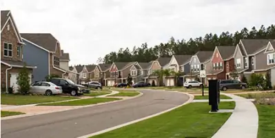
We specialize in large-scale residential subdivisions, including apartment complexes, condominiums, and individual properties. Our precise surveys ensure compliance with local regulations and streamline development timelines. With decades of experience in North Floridas terrain, we deliver cost-effective solutions tailored to each projects unique needs.
Commercial Development
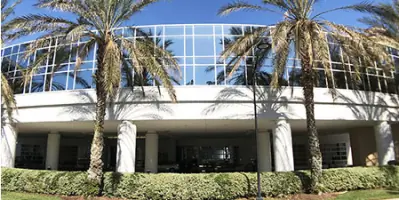
Our team provides comprehensive surveying for commercial sites like business parks and shopping centers. We combine manpower and expertise to meet evolving client demands, ensuring accurate data collection and efficient project execution. Our services support seamless construction planning and regulatory compliance for complex commercial developments.
Transportation
We conduct design and right-of-way surveying for transportation projects, including roads and highways. Our surveys provide critical data for engineering plans, ensuring safe and efficient infrastructure development. With decades of experience, we meet strict project specifications and deadlines for public and private transportation initiatives.
Subsurface Utility Engineering
Using advanced tools, we locate and verify underground utilities to prevent project delays. Our S.U.E. services identify potential conflicts before construction begins, reducing risks and costs. Accurate utility mapping ensures client projects proceed smoothly with minimal disruptions.
Technology
We integrate modern technology to enhance measurement accuracy and data collection speed. Our digital tools improve efficiency, reduce errors, and lower costs for clients. From 3D modeling to GPS systems, our tech-driven approach ensures precise, timely surveying and mapping solutions.
Questions
What services does Clary & Associates offer?
We provide residential and commercial surveying, transportation mapping, subsurface utility engineering, and technology-driven mapping solutions.
How long has Clary & Associates been in business?
We have over 42 years of experience serving North Florida since our founding in 1983.
What areas do you serve?
We primarily serve North Florida, including Jacksonville and surrounding regions.
How do you ensure project accuracy?
We use advanced technology and experienced teams to deliver precise surveys and mapping tailored to local terrain.