Business Details
28 Years
experience
Your Trusted Partner for Geospatial Mapping Solutions in Charlotte
Founded in 1998, Avioimage Mapping Services has established itself as a trusted provider of geospatial solutions in Charlotte, NC. Our team of certified photogrammetrists, professional land surveyors, and spatial data specialists leverages cutting-edge technology to deliver precise mapping and data analysis. We specialize in topographic and planimetric mapping, aerial imagery production, and GIS integration, serving diverse sectors including transportation, utilities, and land development. Our commitment to client collaboration ensures tailored solutions that meet specific project requirements.With decades of combined experience, we prioritize accuracy, innovation, and transparency in every engagement. Our advanced hardware and software workflows enable efficient processing of complex geospatial datasets. By maintaining local expertise and national standards, we provide reliable data that empowers informed decision-making for public and private sector clients. Our reputation for technical excellence and client-focused service has sustained our growth over 25 years in the industry.


Services
Topographic Mapping
Aerial Imagery
GIS Analysis
Photogrammetry
Land Surveying
Details
- Year established: 1998
Highlights and features
- We have 25+ years of local mapping expertise since 1998
- Our team includes certified photogrammetrists and land surveyors
- We offer end-to-end geospatial solutions from data capture to analysis
- We utilize advanced Microdrones and Hexagon Geospatial software
- We treat clients with respect through transparent collaboration
Services
Topographic Mapping
Our topographic mapping service creates detailed terrain models using advanced photogrammetry techniques. We capture elevation data through aerial surveys and ground control measurements to produce accurate 3D representations. This service supports infrastructure planning, floodplain analysis, and construction projects requiring precise elevation information.
Aerial Imagery
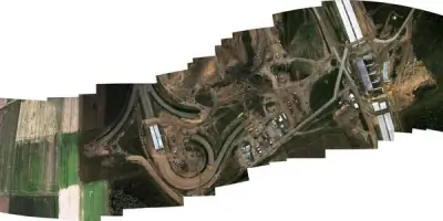
We generate high-resolution orthomosaic imagery using Microdrones and professional cameras. Our process includes image stitching, color balancing, and georeferencing to create seamless aerial maps. These images support land use analysis, project documentation, and web-based mapping applications for clients across multiple industries.
GIS Integration
Our GIS specialists convert CAD data into actionable spatial intelligence. We perform data analysis, create customizable maps, and host geospatial datasets for easy access. This service enables clients to visualize patterns, make data-driven decisions, and manage assets more efficiently through both digital and printed formats.
Photogrammetry
We utilize photogrammetry to create precise 3D models from aerial photographs. Our workflow includes analytical triangulation, control point integration, and feature digitization. This technology supports engineering design, volume calculations, and change detection analysis for construction and environmental monitoring projects.
Land Surveying
Our licensed surveyors provide boundary determination, control layout, and construction staking services. Using Trimble RTK GPS equipment, we establish accurate spatial references for land development projects. This service ensures proper property delineation and supports legal documentation requirements for real estate transactions.
People
Robert Akers
President
25+ years of photogrammetry experience, leading aerial mapping projects and client relations. Licensed Professional Land Surveyor overseeing technical operations and quality control for all geospatial deliverables.
Fransisco Mahecha
Vice President
Licensed surveyor managing field data collection and control network establishment. Specializes in integrating GPS data with aerial imagery to ensure mapping accuracy across large infrastructure projects.
Rudolf Gurlit
Analytical Aerotriangulation Specialist
Expert in image triangulation and spatial referencing. Develops complex mathematical models to align aerial photographs with ground control points, ensuring precise geospatial data alignment for mapping projects.
Cary Watts
Project Manager
Licensed surveyor coordinating project timelines and client communications. Oversees land development mapping initiatives, ensuring deliverables meet technical specifications and regulatory requirements for municipal clients.
Daniel Lenis
GIS Specialist
Transforms raw geospatial data into actionable insights. Develops customized mapping solutions and spatial analysis tools that help clients visualize infrastructure needs and environmental impacts.
Questions
What mapping technologies do you use?
We use Microdrones for aerial capture, Trimble GPS for ground control, and Hexagon Geospatial software for photogrammetry processing to ensure high-accuracy mapping results.
How long have you served Charlotte?
We've provided mapping services to Charlotte-area clients since our founding in 1998, supporting over 1,000 local infrastructure and development projects.
What industries do you work with?
We serve transportation agencies, utility providers, land developers, and environmental consultants needing precise geospatial data for planning and construction projects.
Can you handle large-scale projects?
Yes, our team has experience with statewide roadway mapping initiatives and regional utility network documentation using scalable aerial and ground surveying methods.
Do you provide data hosting solutions?
We offer private online GIS hosting options that allow clients to access and analyze spatial data through mobile, tablet, or desktop devices.