
Business Details
23 Years
experience
Professional Surveying & Mapping Services in Royal Palm Beach, FL
Whidden Surveying & Mapping has provided professional surveying and mapping services since January 2003. Our team includes two licensed surveyors with over 40 combined years of experience in diverse survey types. We specialize in boundary, hydrographic, topographic, and GPS surveys while maintaining a strong focus on client satisfaction. Our expertise extends to horizontal/vertical control, right-of-way, and subdivision platting projects. We utilize advanced technologies like laser scanning to deliver precise 3D mapping solutions.Our construction layout services ensure accurate implementation of project designs. We prepare legal descriptions, sketches, and easement documentation for property-related needs. Our mission emphasizes employee dedication and meeting client deadlines through technical excellence. We serve commercial, residential, and municipal clients across South Florida. Our Royal Palm Beach headquarters supports timely project completion for local and regional assignments.
Services
Boundary Surveys
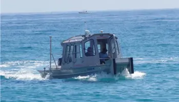
Hydrographic Surveys
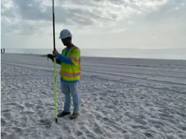
Topographic Surveys
GPS Surveys
Construction Layout
Subdivision Platting
Laser Scanning
Easement Preparation
Control Surveys
As-Built Surveys
Details
- Year established: 2003
Highlights and features
- Licensed surveyors with 40+ combined years of experience
- Offer 8+ specialized surveying service types
- Utilize advanced GPS and laser scanning technologies
- Maintain strict adherence to project deadlines
- Provide comprehensive legal documentation services
Services
Boundary Surveys
Boundary surveys establish property lines through precise measurements and legal document analysis. Our licensed surveyors identify easements and encroachments to resolve disputes and support real estate transactions. This service meets Florida regulatory requirements for land development and title insurance purposes.
Hydrographic Surveys
Hydrographic surveys map underwater terrain for navigation, construction, and water management projects. We use specialized equipment to measure water depths and bed features, supporting infrastructure development in coastal and inland water environments.
Topographic Surveys
Topographic surveys document land surface features and elevation changes. Our detailed contour maps assist architects and engineers with site planning, drainage analysis, and construction design across residential and commercial properties.
Construction Layout
Construction layout services ensure accurate placement of buildings and infrastructure. We translate design plans into physical markers using total stations and GPS technology, maintaining dimensional control throughout project execution.
Laser Scanning
Laser scanning creates high-resolution 3D models of complex environments. This technology captures precise measurements of buildings, landscapes, and infrastructure for as-built documentation and renovation planning purposes.
People
Tom Whidden
President
Tom Whidden, PSM, leads the company with 20+ years of Florida surveying experience. He oversees project execution and technical standards while maintaining client relationships.
Questions
What types of surveying services do you offer?
We provide boundary, topographic, hydrographic, GPS, construction layout, subdivision platting, and laser scanning services for residential, commercial, and municipal projects.
Are your surveyors licensed in Florida?
Yes, we have two licensed Professional Surveyors and Mappers with Florida-specific expertise and 40+ combined years of experience.
How long does a typical survey take?
Project duration varies by complexity but most residential surveys complete within 3-5 business days after site access is granted.
Do you provide legal documentation?
We prepare legal descriptions, easement documents, and as-built surveys that meet county recording requirements for property transactions.
Can you handle commercial development projects?
Our team supports commercial developments with boundary surveys, site planning, and construction layout services tailored to project specifications.