Business Details
50+ Years
experience
Trusted Surveying and Mapping Solutions in Birmingham, AL
Earl Dudley, LLC has been a trusted provider of surveying, mapping, and construction measurement instruments since 1938. Our commitment to excellence is rooted in a legacy of delivering high-quality products and comprehensive service solutions tailored to meet the evolving needs of our clients. Specializing in UAV mapping, 3D laser scanning, machine control, and GNSS technologies, we ensure precision and reliability for projects across the Southeast. Our team of experts combines decades of industry experience with cutting-edge tools to support surveyors, contractors, and precision agriculture professionals. We pride ourselves on offering not just equipment but complete solutions, including training, repair services, and technical support.Our iNET Reference Station Network enhances GPS RTK capabilities, providing unparalleled accuracy for mapping and construction tasks. With locations in Alabama, Mississippi, Tennessee, and South Carolina, we serve a diverse clientele with localized expertise and nationwide reach. Our dedication to customer satisfaction drives every interaction, ensuring that our clients receive the highest level of service before, during, and after every transaction. By upholding the values established by Earl Dudley, we continue to innovate while maintaining the trust and loyalty of our customers. Our mission is to empower professionals with the tools and knowledge needed to succeed in todays competitive landscape.

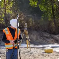
Services
UAV Mapping
3D Laser Scanning
Machine Control
Mobile Mapping
GNSS Solutions
Details
- Year established: 1938
Highlights and features
- We offer over 85 years of expertise in surveying and construction instrumentation.
- Our team provides comprehensive service and technical support for all products.
- We specialize in cutting-edge technologies like UAV mapping and 3D laser scanning.
- Our iNET Reference Station Network ensures superior GPS RTK accuracy.
- We serve multiple Southeastern states with localized expertise and nationwide resources.
Services
UAV Mapping
Our UAV mapping services utilize advanced drone technology to capture high-resolution aerial data for land surveying, construction monitoring, and environmental assessments. This solution provides rapid data collection, reduced labor costs, and detailed topographic analysis for projects of all scales. Ideal for surveyors and engineers requiring accurate geospatial data in challenging terrains.
3D Laser Scanning
3D laser scanning creates precise digital replicas of physical environments for construction, industrial, and heritage preservation projects. Our equipment captures millions of data points per second, ensuring millimeter-level accuracy for as-built documentation and structural analysis. This technology streamlines design workflows and minimizes rework for complex infrastructure projects.
Machine Control
Machine control systems integrate GPS and laser technology to guide heavy equipment for grading, paving, and excavation tasks. Our solutions enhance productivity by reducing manual measurements, improving material efficiency, and ensuring adherence to project specifications. Contractors benefit from real-time feedback and reduced project timelines.
GNSS Solutions
GNSS solutions deliver centimeter-level positioning accuracy for surveying, mapping, and agricultural applications. Our systems combine GPS, GLONASS, Galileo, and BeiDou satellite signals to ensure reliable performance in diverse environments. These tools support land development, utility mapping, and precision farming operations.
iNET Reference Station Network
The iNET network provides real-time kinematic corrections for enhanced GPS accuracy across the Southeast. By integrating data from multiple satellite constellations, this service enables surveyors and contractors to achieve sub-inch precision for mapping, construction, and monitoring tasks. It eliminates the need for base stations, reducing equipment costs and setup time.
People
Mitch Ricketts
Inside Sales and Support
Mitch Ricketts brings over 15 years of experience in surveying equipment sales and technical support. He specializes in matching clients with precision instruments tailored to their project requirements.
Brooks Blakey
Director UAVs
Brooks Blakey leads our UAV initiatives with expertise in drone technology and aerial data collection. He has implemented drone solutions for infrastructure and environmental projects across the Southeast.
Drew Dearman
Construction and Survey Specialist
Drew Dearman offers 20 years of field experience in construction layout and surveying. His technical knowledge ensures clients receive optimal equipment configurations for complex site developments.
Brian Singleton
3D Machine Control Expert
Brian Singleton specializes in 3D machine control systems, helping contractors improve grading accuracy and efficiency. His background includes hands-on implementation for large-scale earthmoving projects.
Wayne Thames
Topcon 3D MC Specialist
Wayne Thames provides expert guidance on Topcon machine control solutions. With a focus on paving and road construction, he ensures clients maximize productivity through advanced technology integration.
Questions
What industries does Earl Dudley, LLC serve?
We serve surveying, construction, precision agriculture, industrial measurement, and mapping professionals with specialized equipment and technical solutions.
Do you offer equipment repair services?
Yes, we provide comprehensive repair and maintenance services for all surveying and machine control instruments we sell.
Is training available for new equipment purchases?
We offer hands-on training sessions to ensure clients maximize the capabilities of their surveying and construction technology investments.
What geographic areas do you cover?
Our primary service areas include Alabama, Mississippi, Tennessee, and South Carolina, with nationwide support capabilities.
Can I access the iNET Reference Station Network remotely?
Yes, the iNET network provides internet-based GPS RTK corrections accessible across the Southeastern United States for registered users.
Do you sell pre-owned surveying equipment?
We offer certified pre-owned GPS systems, total stations, drones, and other surveying instruments with full technical support.