
Business Details
24 Years
experience
Professional Surveying & Mapping Services in Fort Myers
E F Gaines Surveying Services has provided technical surveying and mapping support since 2002. Our founder, Elizabeth F. Gaines, brings over 35 years of industry experience, including two decades at a leading Florida civil engineering firm. We specialize in CADD services, legal descriptions, parcel mapping, and QA/QC reviews for engineering firms and municipalities. Our focus shifted in 2022 to exclusively office-based support, emphasizing collaboration, transparency, and client partnerships.We maintain WBE/DBE certifications through the State of Florida and Florida Department of Transportation. Our technical reviews have supported Fort Myers subdivision plats for a decade, ensuring accuracy before public record submission. We prioritize precision in creating digital terrain models, subdivision plats, and GIS-compatible parcel mapping. Our process combines technical expertise with personalized service, delivering error-free deliverables for complex land development projects.
Services
CADD Services
Legal Descriptions
Parcel Mapping
Technical Peer Review
GIS Services
Details
- Year established: 2002
Highlights and features
- 35+ years of Florida surveying experience
- Specialized CADD and GIS integration capabilities
- Certified legal description preparation expertise
- 10+ years of municipal plat review experience
- WBE/DBE certified for government contracting
Associations and certifications
- WBE/DBE - State of Florida
- WBE/DBE - Florida Department of Transportation
What people say
Very professional
Extremely efficient
Timely
Willing to go above and beyond
Services
CADD Services
We create precise AutoCAD drawings and digital terrain models using Civil3D software. Our CADD services convert client field data into professional-grade subdivision plats, condominium exhibits, and building plot plans. This technical support ensures accurate visualization and documentation for engineering projects.
Legal Descriptions
We prepare metes and bounds, fractional, and coordinate-based legal descriptions for utility easements and parcel creations. Each description includes graphic sketches and meets legal requirements for public record submission. Our expertise ensures compliance with Florida land documentation standards.
Parcel Mapping
We create GIS-compatible parcel linework using coordinate geometry from deeds and plats. Our mapping integrates with state plane coordinate systems for accurate spatial representation. This service supports municipal planning and land development projects requiring precise digital parcel data.
Technical Peer Review
We provide quality assurance reviews using client or proprietary processes. Our services include error detection in subdivision plats for Fort Myers municipalities. Optional field walk-throughs verify mapping accuracy against physical site conditions, ensuring error-free public record submissions.
GIS Services
We deliver GIS-ready parcel mapping with coordinate geometry integration. Our services support spatial analysis for land development projects. We ensure accurate alignment with existing GIS layers and coordinate systems for seamless municipal database incorporation.
People
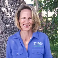
Elizabeth F. Gaines
Professional Surveyor & Mapper
Certified surveyor with 35+ years Florida experience. Former civil engineering firm professional. Specializes in technical surveying support, legal descriptions, and GIS integration. WBE/DBE certified. Committed to client collaboration and precision mapping solutions.
Questions
What surveying services do you offer?
We provide CADD services, legal descriptions, parcel mapping, GIS integration, and technical peer reviews for engineering firms and municipalities.
How long have you been in business?
We've operated since 2002, with our founder having 35+ years of Florida surveying experience.
What makes your services unique?
Our combination of field experience, technical expertise, and WBE/DBE certifications enables specialized support for complex land development projects.
Do you work with municipalities?
Yes, we've provided technical reviews for Fort Myers subdivision plats for over a decade.
Are you certified for government contracts?
We hold WBE/DBE certifications from the State of Florida and Florida Department of Transportation.
How do you ensure accuracy?
Through rigorous QA/QC processes, field walk-throughs, and 35+ years of technical expertise in Florida land surveying standards.