Business Details
26 Years
experience
Professional Land Surveying Services in Sarasota, FL
MSB Surveying has been delivering precise land surveying and mapping services since 2000, leveraging cutting-edge GPS, GIS, and robotic technologies to meet the needs of public and private sector clients. Our team of seasoned professionals brings decades of combined experience in boundary surveys, hydrographic studies, and construction layout projects across Sarasota, Manatee, and Charlotte Counties. We maintain a strong commitment to ethical standards and regulatory compliance while fostering long-term relationships through technical excellence and client-focused solutions. Our expertise spans historical research, tidal boundary determination, and ALTA/ACSM surveys, supported by a proven track record of resolving complex property disputes.With second- and third-generation surveyors on staff, we combine generational knowledge with modern methodologies to ensure accuracy in every project. Our mission emphasizes timely delivery of high-quality services while protecting public interests through adherence to Florida state regulations. Continuous investment in advanced equipment and staff development maintains our position as a trusted leader in the surveying industry.
Services
Boundary Surveys
Topographic Surveys
Hydrographic Surveys
Construction Layout
ALTA/ACSM Surveys
FEMA Elevation Certificates
Subdivision Platting
As-Built Surveys
Riparian Line Determination
Tidal Datum Studies
Details
- Year established: 2000
Highlights and features
- We offer 46 years of combined experience in Florida land surveying
- Our team includes second- and third-generation surveying professionals
- We utilize advanced GPS and robotic technologies for precise measurements
- Our staff serves as expert witnesses in boundary dispute cases
- We maintain active professional affiliations with surveying societies
Associations and certifications
- State of Florida - Land Surveyor and Mapper LS#5538
- State of Florida - Licensed Business LB #7044
- Manasota Chapter of the Florida Surveying & Mapping Society
What people say
Outstanding quality
Unparalleled professionalism
Accurate surveys
Timely fashion
Thorough job
Services
Boundary Surveys
Establish or re-establish property boundaries through precise monument location and boundary line determination. Our team handles mortgage closings, boundary disputes, and land division projects using advanced robotic technology. We provide legally defensible documentation for property transactions and development projects.
Topographic Surveys
Create detailed elevation maps showing natural and man-made features for drainage planning and construction projects. We utilize GPS technology to produce accurate contour maps that meet municipal permitting requirements for residential and commercial developments.
Hydrographic Surveys
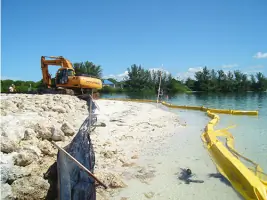
Map submerged lands including seagrass beds, oyster beds, and tidal elevations for dock construction and dredging permits. Our team specializes in mean high water line determination and riparian rights assessments for coastal property owners.
Construction Layout
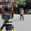
Provide precise field marking for new construction projects including residential homes, commercial buildings, and infrastructure developments. Our surveyors use robotic total stations to ensure accurate placement of structures according to approved plans.
ALTA/ACSM Surveys
Conduct comprehensive land surveys meeting American Land Title Association standards for title insurance purposes. We produce detailed maps showing property boundaries, easements, and improvements to support commercial real estate transactions.
People
Martin Scott Britt
Owner/President/Surveyor & Mapper
46-year industry veteran and second-generation surveyor specializing in boundary disputes, tidal studies, and expert witness testimony. Licensed in Florida with LS#5538 and LB #7044 registrations. Educator for professional certification courses statewide.
Richard Abernathy
Vice-President
Licensed surveyor with 25+ years experience in coastal surveys and digital terrain modeling. Graduated Magna Cum Laude from University of Florida with Geomatics degree. Oversees CADD operations and field crews for Sarasota County projects.
Sandra Britt Culpepper
Office Manager
30-year surveying professional with expertise in site planning and FEMA elevation certificates. Manages daily business operations while providing technical support for boundary and topographic surveys across three Florida counties.
Ryan Britt
CADD Technician
Third-generation surveyor with 10+ years field experience. Specializes in robotic surveying and IT systems management. Provides technical support for boundary, hydrographic, and construction stake-out projects in Southwest Florida.
James Copeland
Head Crew Chief
24-year surveying veteran with expertise in boundary determination and construction stake-outs. Former US Marine Corps infantryman who manages field crews and proposal estimations for residential and municipal projects in Sarasota County.
Questions
What types of surveying services do you offer?
We provide boundary surveys, topographic mapping, hydrographic studies, construction layout, ALTA/ACSM surveys, FEMA elevation certificates, and subdivision platting services for residential, commercial, and municipal clients.
How do you handle complex boundary disputes?
Our experienced surveyors combine historical research with modern technology to resolve disputes, supported by expert witness testimony when required for legal proceedings.
Are your surveys compliant with Florida regulations?
All our services strictly follow Florida state regulations and licensing requirements, with staff maintaining active LS#5538 and LB #7044 registrations.
Can you assist with permitting requirements?
Yes, we help navigate municipal permitting processes and provide surveys that meet specific agency requirements for DEP, SWFWMD, and local governments.
What technology do you use for surveys?
We utilize GPS, robotic total stations, GIS mapping, and digital terrain modeling to ensure precise and efficient surveying solutions for all project types.
How quickly can you complete a survey?
Project timelines vary by complexity, but we prioritize timely delivery while maintaining accuracy, with emergency services available for urgent requests.