
Business Details
Trusted Land Surveying Services in Florida
360 Surveying Services is a full-service land surveying company dedicated to delivering precise and reliable data for residential and commercial projects across Florida's Emerald Coast and Suncoast regions. Our experienced team specializes in both land and hydrographic surveying, offering tailored solutions that include ALTA Surveys, Elevation Certificates, Topographic Surveys, Boundary Surveys, Construction Layouts, and Hydrographic Surveys. We prioritize client collaboration, providing itemized proposals and rate sheets to ensure transparency and efficiency.With expertise in FEMA-designated flood hazard zone certifications and FDEP-compliant coastal surveys, we support projects from initial site assessments to final construction. Our commitment to accuracy and client satisfaction has earned us a reputation as a trusted partner in land development, serving counties including Escambia, Santa Rosa, Walton, and Hillsborough. We operate with a focus on professionalism, technical excellence, and community-driven service, ensuring every project benefits from our deep local knowledge and industry experience.
Services
ALTA Surveys
Boundary Surveys
Elevation Certificates
Topographic Surveys
Construction Layouts
Hydrographic Surveys
Highlights and features
- We offer over 20 years of combined experience in land and hydrographic surveying.
- Our team provides itemized proposals and rate sheets for transparent pricing.
- We specialize in FEMA elevation certificates and FDEP-compliant coastal surveys.
- Our services cover all project phases from site assessment to construction staking.
- We serve 10+ Florida counties with localized expertise and rapid response times.
What people say
Extremely pleased
HIGHLY recommend
Awesome company
Accurate
Reasonable rate
Services
ALTA Surveys
ALTA Surveys meet American Land Title Association standards for commercial property transactions. These detailed boundary surveys include easements, encroachments, and improvements. Our ALTA Surveys provide title companies and lenders with accurate data to minimize risk for high-value real estate deals.
Elevation Certificates
Elevation Certificates verify building elevations in FEMA-designated flood zones. Required for flood insurance compliance, these documents show base flood elevations and structural details. We complete certificates efficiently for new construction or property improvements in coastal Florida.
Construction Layouts
Construction Layouts translate architectural plans into physical markers on-site. We perform building layout, utility staking, and earthwork measurements with precision. Our team supports contractors with control networks and as-built surveys to ensure accurate project execution.
Hydrographic Surveys
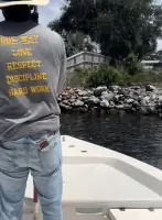
Hydrographic Surveys map underwater terrain for coastal and inland water projects. We conduct volume surveys, mean high water determinations, and FDEP-compliant submerged land assessments. These surveys support dredging operations, marina development, and environmental monitoring along Florida's waterways.
Topographic Surveys
Topographic Surveys capture natural and man-made features with elevation data. These maps show contours, vegetation, and structures to support site planning. We use advanced equipment to create accurate topographical representations for residential and commercial development projects.
Questions
What types of surveying services do you offer?
We provide ALTA Surveys, Elevation Certificates, Topographic Surveys, Boundary Surveys, Construction Layouts, and Hydrographic Surveys for residential and commercial clients in Florida.
Do you serve areas outside Northwest Florida?
Yes, we serve both the Emerald Coast and Suncoast regions, covering 10+ counties including Hillsborough, Manatee, and Lee County across Florida.
How are survey results documented?
Surveys are recorded as two-dimensional maps showing property boundaries. Recorded plats are filed with the Register of Deeds office, while unrecorded maps remain in our permanent archives.
Can you handle urgent survey requests?
Yes, we prioritize timely service and have accommodated emergency requests for real estate transactions, completing surveys within tight deadlines when required.
What factors affect survey costs?
Costs depend on property size, survey type, location, terrain complexity, and required deliverables. We provide itemized proposals after discussing your specific project requirements.