Business Details
44 Years
experience
Your Trusted Land Surveying Partner in Knoxville, TN
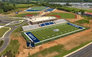
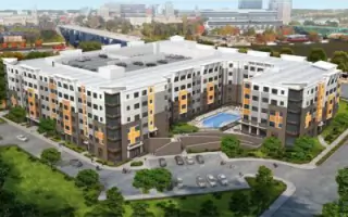
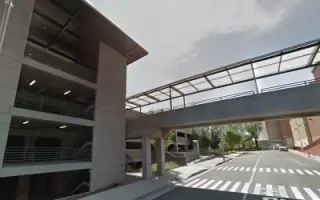
Established in 1982, Lynch Survey has built a reputation as a trusted provider of comprehensive land surveying services across Tennessee. Our commitment to excellence is driven by decades of experience and the integration of cutting-edge technology, including survey-grade RTK GPS systems, robotic total stations, UAV drone mapping, and industry-standard AutoCAD software. We specialize in delivering precise and reliable surveying solutions tailored to meet the unique demands of each project, from topographic and ALTA/NSPS land title surveys to subdivision and boundary surveys. Our team prioritizes client confidence by ensuring accuracy, efficiency, and transparency throughout every phase of the process. With a focus on innovation and quality, we have supported landmark projects such as the University of Tennessee Pat Summitt Plaza and Lakeway Christian Academy campus development.Our expertise extends to 3D photographic imagery, which provides high-definition visual representations for design validation and promotional use. As a full-service firm, we streamline surveying workflows to save clients time and resources while maintaining the highest standards of professionalism. Our work has been instrumental in shaping Tennessee's infrastructure, commercial developments, and residential communities for over 50 years. We remain dedicated to advancing our craft through continuous adoption of technological advancements and adherence to industry best practices.
Services
Topographic Surveys
ALTA Surveys
Subdivision Surveys
Boundary Surveys
3D Photographic Imagery
Details
- Year established: 1982
Highlights and features
- We have over 50 years of experience in Tennessee land surveying.
- Our team uses RTK GPS, robotic total stations, and UAV drone mapping.
- We provide full-service surveying solutions for all project phases.
- Our 3D photographic imagery enhances project visualization and documentation.
- We maintain strict adherence to ALTA/NSPS standards for title insurance.
Services
Topographic Surveys
Topographic surveys locate natural and man-made features including buildings, elevations, land contours, and streams. Our surveys provide critical data for construction planning, environmental assessments, and property development. Clients receive detailed maps showing terrain characteristics and existing site conditions to support informed decision-making.
ALTA Surveys
ALTA/NSPS land title surveys meet strict standards for title insurance purposes. We produce detailed maps showing property boundaries, easements, and improvements that satisfy lender and title company requirements. Our surveys include monumentation records and mathematical data to ensure legal compliance and risk mitigation for commercial transactions.
Subdivision Surveys
Subdivision surveys divide land into parcels following local government ordinances. We create plats showing lot dimensions, streets, and utility easements required for municipal approval. Our work ensures proper monumentation and legal description accuracy for residential and commercial developments.
3D Photographic Imagery
3D photographic records provide high-definition visual representations of survey sites. This technology enables virtual walkthroughs and documentation of pre- and post-construction conditions. Clients use these models for design validation, marketing materials, and dispute resolution through accurate spatial visualization.
Boundary Surveys
Boundary surveys establish legal property lines through historical research and field measurements. We locate existing monuments and resolve encroachment issues while preparing documentation for real estate transactions. Our surveys comply with state standards to protect property rights and prevent future disputes.
Questions
What types of surveying services do you offer?
We provide topographic, ALTA/NSPS, subdivision, boundary, lot split, mortgage, and volumetric surveys, along with 3D photographic imagery for Tennessee properties.
How does your 3D imaging technology benefit projects?
Our 3D photographic records allow virtual site walkthroughs, help identify design challenges, and provide documentation for construction handover or marketing purposes.
Do you serve all areas of Tennessee?
Yes, we provide surveying services statewide, supporting projects in both urban centers like Knoxville and rural communities across Tennessee.
What technology do you use for surveys?
We utilize RTK GPS systems, robotic total stations, UAV drones, and AutoCAD software to ensure precision and efficiency in all surveying projects.
How long does a typical survey project take?
Project duration varies by scope, but we completed the University of Tennessee Pat Summitt Plaza survey in under 70 days using our streamlined processes.