Business Details
Trusted Land Surveying & Geospatial Services in Florida
Allen & Company & Company has been a leader in professional surveying, mapping, and geospatial services for over 35 years. Our team of more than 110 professionals, including seven licensed Land Surveyors, delivers accurate data and innovative solutions to clients across architecture, engineering, construction, healthcare, theme parks, and industrial sectors. We combine traditional surveying methods with advanced technologies like UAS aerial mapping and LiDAR processing to support complex projects. Headquartered in Winter Garden, Florida, we serve commercial and industrial clients throughout the U.S. with aerial, land surface, and hydrographic surveying solutions.Our reputation for trust, communication, and performance has made us a preferred partner for master-planned developments, commercial real estate, and infrastructure projects. We prioritize client collaboration, tailoring solutions to individual project needs while maintaining rigorous quality standards. With decades of experience and a commitment to cutting-edge technology, we help clients achieve measurable results in site evaluation and design.

Services
Land Surveying
Aerial Mapping
Hydrographic Mapping
Construction Surveying
Laser Scanning
Highlights and features
- We have over 35 years of experience in commercial and industrial surveying.
- Our team includes seven licensed Professional Surveyors and Mappers.
- We utilize advanced technologies like UAS aerial mapping and LiDAR processing.
- We serve diverse industries including healthcare, theme parks, and energy.
- Our client-focused approach ensures tailored solutions for complex projects.
What people say
High degree of competence
Understand our needs
Deliver value
Trusted strategic partner
Invaluable insight
Services
Land Surveying
Allen & Company & Company provides comprehensive land surveying services including boundary determination, topographic mapping, and cadastral surveys. Our licensed professionals use precision instruments and advanced software to ensure accurate property delineation. Clients rely on our data for legal documentation, construction planning, and land development projects across Florida and the Southern U.S.
Aerial Mapping
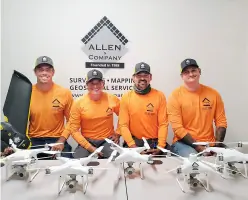
Our aerial mapping services utilize Unmanned Aerial Systems (UAS) to capture high-resolution imagery for topographic modeling and site analysis. This technology enables efficient data collection over large areas, supporting infrastructure projects, environmental assessments, and urban planning initiatives with detailed geospatial information.
Hydrographic Mapping
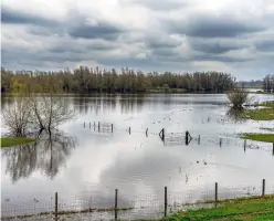
We conduct hydrographic surveys to map underwater terrain and coastal environments. Using specialized sonar equipment and GPS technology, our team collects bathymetric data for dredging projects, floodplain analysis, and marine construction. This service supports accurate water resource management and environmental compliance.
Construction Surveying
Our construction surveying services ensure precise implementation of engineering designs during building projects. We provide stakeout, elevation control, and as-built documentation for commercial developments, transportation infrastructure, and utility installations. Real-time data helps contractors maintain alignment and avoid costly errors.
Laser Scanning
Allen & Company & Company employs terrestrial laser scanning to create detailed 3D models of existing structures and landscapes. This non-invasive technology captures millions of data points per second, enabling accurate as-built documentation for renovation projects, industrial facilities, and heritage preservation efforts.
Questions
What industries does Allen & Company & Company & Company serve?
We support architecture, engineering, construction, healthcare, theme parks, power generation, and commercial real estate sectors with surveying and geospatial solutions.
What technologies do you use for surveying?
Our tools include UAS aerial mapping, LiDAR scanning, GPS systems, and hydrographic sonar equipment for comprehensive data collection.
Are your surveyors licensed professionals?
Yes, our team includes seven licensed Professional Surveyors and Mappers with extensive industry expertise.
Do you work on large-scale development projects?
We specialize in complex commercial and industrial projects including master-planned communities, healthcare facilities, and infrastructure developments.
How do you ensure survey accuracy?
We combine traditional methods with advanced technology and maintain rigorous quality control throughout all project phases.
Videos