
Business Details
50+ Years
experience
Trusted Florida Surveying & Mapping Services Since 1973
Manuel G Vera & Associates has been a trusted provider of surveying and mapping services in Florida since 1973. Our family-owned business philosophy emphasizes personalized service and unwavering commitment to quality, resulting in long-term client relationships and repeat contracts. We specialize in delivering precise surveying solutions for both public and private clients, including the Florida Department of Transportation, where we have maintained continuous service contracts since 1997. Our team consistently invests in cutting-edge technologies like GPS RTK, laser scanning, and hydrographic surveying to meet evolving client needs.We pride ourselves on understanding project requirements and delivering actionable data that supports successful outcomes. By maintaining direct collaboration with design teams, we ensure our work becomes an integral part of every project's success. Our 40+ years of experience and technological expertise position us as a reliable extension of our clients' teams. We remain dedicated to advancing our capabilities while upholding the core values that have defined our practice since inception.
Services
Surveying
GPS Survey
Topographic Survey
Hydrographic Survey
Utility Locates
3D Rendering
Aerial Photogrammetry
Right of Way Survey
Subsurface Utility Engineering
Construction Survey
Details
- Year established: 1973
Highlights and features
- We have 40+ years of experience in Florida surveying and mapping
- Our family-owned business prioritizes personalized client relationships
- We utilize advanced technologies like GPS RTK and laser scanning
- Maintained continuous FDOT service contracts since 1997
- Deliver actionable geospatial data tailored to project requirements
Services
Surveying
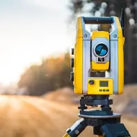
Our comprehensive surveying services provide precise boundary determinations and property measurements. Using GPS RTK and traditional methods, we deliver accurate data for land development, legal documentation, and infrastructure projects. Our team's expertise ensures compliance with Florida's specific geospatial requirements.
Hydrographic Survey
We conduct detailed underwater mapping using specialized sonar equipment to chart submerged surfaces. This service supports coastal engineering, bridge foundation assessments, and environmental monitoring projects across Florida's waterways. Our hydrographic surveys meet federal and state regulatory standards.
Utility Locates
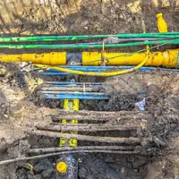
Our subsurface utility engineering identifies buried infrastructure using ground-penetrating radar and electromagnetic detection. This service follows ASCE 38-02 standards to prevent damage during construction projects. We provide detailed maps of utility networks for safe excavation planning.
3D Rendering
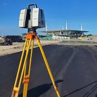
We create detailed three-dimensional models of infrastructure and terrain using laser scanning technology. These digital twins support design visualization, construction planning, and asset management for transportation and development projects across Florida.
Aerial Photogrammetry
Our aerial surveying captures high-resolution imagery using drones to create accurate topographic maps. This service provides rapid data collection for large areas, supporting land development, environmental assessments, and infrastructure monitoring projects.
Questions
What surveying services do you offer?
We provide GPS surveying, topographic mapping, hydrographic surveys, utility locating, 3D modeling, and aerial photogrammetry for public and private clients across Florida.
How long have you served Florida clients?
We've provided surveying services in Florida since 1973, maintaining continuous contracts with the Florida Department of Transportation since 1997.
What technologies do you use?
We utilize GPS RTK, laser scanning, ground-penetrating radar, hydrographic sonar, and drone-based photogrammetry to deliver precise geospatial data.
Which areas do you cover?
We primarily serve Central and South Florida, working across FDOT Districts 1 through 7 and the Florida Turnpike system.
How do you ensure data accuracy?
We combine traditional surveying methods with modern technologies and maintain continuous equipment upgrades to meet evolving industry standards.