Business Details
24 Years
experience
Trusted Surveying & Mapping Services in DeLand, FL
Efird Surveying Group was established in 2002 in DeLand, Florida, and has since completed over 20,000 surveys and 1,000 construction projects. Our team combines decades of local expertise with advanced technology to deliver accurate, timely surveying and mapping services across Central Florida. We specialize in commercial, boundary, topographic, and utility surveys, as well as construction staking and wetland delineation. Our owner-operated structure ensures personalized service, with direct oversight from our licensed Professional Surveyor and Mapper.We maintain a fleet of field crews supported by CAD drafting technicians to handle projects of all sizes, from residential properties to large-scale developments. Our commitment to fast turnaround times and competitive pricing makes us a trusted partner for clients across Volusia County and beyond. With deep roots in the community and a focus on client satisfaction, we aim to exceed expectations on every project.
Services
Commercial Surveys
Boundary Surveys
Topographic Surveys
Utility Surveys
Construction Staking
Wetland Delineation
Tree Surveys
As-Built Surveys
Elevation Certificates
Subdivision Mapping
Details
- Year established: 2002
Highlights and features
- Established in 2002 with over 20,000 completed surveys
- Licensed Professional Surveyor oversees all projects directly
- Competitive pricing with guaranteed timely delivery
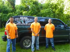
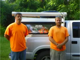
- Three specialized field crews serving Central Florida
- Proven track record with commercial and residential clients
Services
Commercial Surveys
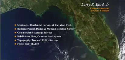
Our commercial surveys provide precise boundary and topographic data for development projects, ensuring compliance with zoning regulations and construction requirements. We deliver detailed AutoCAD drawings via email or physical media, supporting clients from initial planning through project completion across Central Florida.
Boundary Surveys
We conduct thorough boundary surveys to establish property lines, resolve disputes, and prepare for legal transactions. Using advanced digital terrain modeling, our team delivers accurate documentation for residential and commercial properties, supported by 30+ years of local surveying expertise.
Topographic Surveys
Our topographic surveys capture elevation changes, natural features, and man-made structures to create detailed site maps. This data supports construction planning, drainage analysis, and environmental assessments, delivered with rapid turnaround times to keep projects on schedule.
Construction Staking
We provide precise construction staking for roadways, buildings, and infrastructure projects. Our field crews use GPS and robotic total stations to mark critical points, ensuring accurate implementation of engineering plans for developers and contractors across multiple counties.
Elevation Certificates
We complete FEMA-compliant elevation certificates for flood insurance requirements, including updated 100-year floodplain data. These critical documents help property owners in Volusia County and surrounding areas determine risk levels and secure appropriate coverage.
People
Larry R. Efird, Jr.
President & Professional Surveyor
With over 30 years of experience since 1980, Larry leads our surveying operations and brings extensive local knowledge from decades working across Volusia County's east and west sides. He manages project coordination and client relations.
Marjorie Efird
Administrative Assistant
Handling office administration and scheduling, Marjorie ensures smooth operations and timely delivery of surveying services while maintaining client communication and project timelines.
Jane Morris
Sr. CAD Drafting Technician
Jane manages electronic survey drawings and construction as-builts while providing technical support and training, leveraging her expertise in digital mapping and client project coordination.
Justin Efird
Field Crew Coordinator
With 10 years of FDOT project experience, Justin oversees data collection crews and manages construction layout projects, applying specialized electronic data expertise to complex surveying tasks.
Dave Martin
Survey Crew Chief
Specializing in large parcel surveys, Dave brings deep local knowledge and technical proficiency to boundary and topographic mapping projects across Central Florida's diverse terrain.
Questions
What surveying services do you offer?
We provide commercial, boundary, topographic, utility, construction staking, wetland delineation, and elevation certificate services across Central Florida.
Which areas do you serve?
We operate throughout Volusia, Lake, Marion, Flagler, St. Johns, Putnam, Seminole, Brevard, and Orange Counties in Florida.
How quickly can you complete a survey?
Our typical lead time is 3-4 weeks due to high demand, with priority given to time-sensitive projects while maintaining accuracy standards.
Do you handle both commercial and residential projects?
Yes, we serve commercial developers, residential clients, and government agencies with tailored surveying solutions for all property types.
How do you deliver survey results?
We provide digital AutoCAD files via email, PDF, or physical media, ensuring compatibility with client needs and project requirements.
Who leads your surveying team?
Our owner, Larry Efird, Jr., a licensed Professional Surveyor with 30+ years of local experience, directly oversees all operations and project management.