
Business Details
29 Years
experience
Professional Land Surveying Services in Clarksville, TN
Founded in 1997, Byrd Surveying has established itself as a trusted provider of comprehensive land surveying solutions across Tennessee, Kentucky, and Alabama. Our team of certified professionals brings over 25 years of combined experience to deliver precise data and technical expertise for commercial construction, residential development, and infrastructure projects. Specializing in boundary surveys, topographic mapping, and ALTA/NSPS standards compliance, we support over 15 homebuilders in Middle Tennessee while completing more than 22,000 projects to date. Utilizing advanced equipment and methodologies, we ensure accurate site analysis from initial planning through final implementation.Our commitment to quality extends to detailed courthouse research, zoning coordination, and customized plat design services. With daytime operations Monday through Friday, we maintain rigorous quality control across all survey types including erosion control assessments and elevation certifications. Our multidisciplinary approach combines technical precision with client-focused service, serving both local contractors and national developers across diverse project scales.
Services
Land Surveying
Construction Layout
Topographic Surveys
Boundary Determination
Subdivision Planning
Elevation Certification
Erosion Control Assessment
ALTA/NSPS Surveys
Details
- Year established: 1997
Highlights and features
- 25+ years of experience in land surveying across three states
- Utilize advanced technical equipment for precise data collection
- Specialize in 12+ survey types including ALTA/NSPS standards
- Serve 15+ homebuilders with customized subdivision planning
- Maintain quality control from initial research to final implementation
Services
Land Surveying
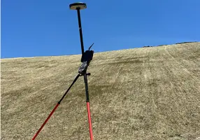
Our comprehensive land surveying services provide precise boundary determination and site analysis for residential and commercial properties. Using advanced GPS technology, we deliver accurate measurements for property transactions, development planning, and legal documentation. Our team ensures compliance with state and federal regulations while maintaining exceptional data accuracy.
Construction Layout
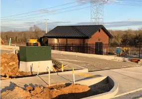
We translate architectural plans into physical site markers through precise construction layout services. Our team establishes exact building corners, utility locations, and elevation benchmarks to guide development projects. This critical process ensures proper alignment of structures and infrastructure according to approved designs.
Topographic Surveys
Our topographic surveys capture detailed elevation data and natural features for site development planning. By creating accurate contour maps, we help engineers and architects design improvements that work with existing terrain conditions. This includes identifying drainage patterns and potential construction challenges.
Boundary Determination
We conduct thorough boundary surveys to establish legal property limits through historical research and physical measurements. Our services include locating existing monuments, resolving encroachment issues, and preparing legal descriptions for land transactions or disputes.
Subdivision Planning
We support residential and commercial subdivision projects with comprehensive surveying solutions. Our services include plat design, infrastructure layout, and erosion control planning to meet local zoning requirements. We work closely with developers to optimize land use while maintaining regulatory compliance.
Questions
What surveying services do you offer?
We provide boundary surveys, topographic mapping, construction layout, ALTA/NSPS surveys, subdivision planning, elevation certifications, and erosion control assessments for residential and commercial projects.
Which areas do you serve?
We operate throughout Tennessee, Kentucky, and Alabama with primary offices in Clarksville, TN serving Middle Tennessee's 15+ homebuilder partners.
How long have you been in business?
Byrd Surveying has provided professional land surveying services since 1997, completing over 22,000 projects across three states during our 25+ years of operation.
What makes your services different?
We combine 25+ years of experience with advanced surveying technology to deliver precise data. Our team maintains quality control from initial research through final implementation for all project types.
How do you handle complex projects?
Our multidisciplinary approach includes courthouse research, zoning coordination, and customized plat design. We utilize advanced equipment for accurate data collection and maintain strict quality control throughout the process.
What's your operating schedule?
Our office operates Monday through Friday from 7:30 AM to 4:30 PM Central Time. Field operations follow similar daytime hours with after-hours emergency services available upon request.