Business Details
42 Years
experience
Trusted Land Surveying & Engineering Services in Columbia City, IN
Since 1984, Walker & Associates has been a trusted provider of land surveying and engineering services in Northeast Indiana. Our team combines decades of experience with advanced technical expertise to deliver precise measurements and tailored solutions for residential, commercial, and construction projects. We prioritize accuracy and attention to detail, ensuring clients receive reliable data for property boundaries, easements, and floodplain determinations. As a locally rooted company, we maintain deep connections to the communities we serve, including Kosciusko, Whitley, and Noble Counties. Our commitment to excellence extends to specialized services like elevation certificates, subdivision design, and Letter of Map Amendments.We work closely with developers, real estate agents, and construction firms to mitigate risks and streamline project planning. Every survey we complete reflects our dedication to quality customer service and technical proficiency. With over 40 years of operational history, we continue to invest in modern tools and methodologies to meet evolving industry standards. Our clients benefit from transparent communication, timely execution, and documentation that meets regulatory requirements. Whether handling complex legal descriptions or foundational construction surveys, we approach every task with the same rigorous standards that have defined our reputation since 1984.


Services
Legal Descriptions
Easement Documentation
Elevation Certificates
Letter of Map Amendment
Plot Plans
Subdivision Design
Boundary Surveys
Topographic Surveys
ALTA Surveys
Foundation Surveys
Details
- Year established: 1984
Highlights and features
- We have over 40 years of experience in land surveying and engineering
- We serve 13 Indiana counties including Kosciusko and Whitley
- Our team maintains rigorous attention to measurement accuracy
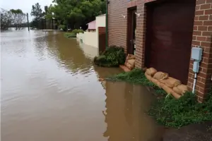
- We provide specialized floodplain analysis and FEMA documentation
- We offer tailored solutions for residential, commercial, and construction clients
Services
Legal Descriptions
We create precise legal descriptions that uniquely define property boundaries for real estate transactions. Our surveys include historical analysis and updated documentation to meet title insurance requirements. Clients receive clear, defensible descriptions that prevent future boundary disputes.
Elevation Certificates
Our elevation certificates determine building elevations relative to floodplain base flood elevations. This documentation satisfies National Flood Insurance Program requirements and helps property owners obtain accurate flood insurance rates while ensuring compliance with local building codes.
Letter of Map Amendment
We prepare technical submissions to FEMA for removing properties from designated flood hazard areas. Our process includes elevation surveys and documentation proving structures meet or exceed base flood elevation requirements for flood insurance adjustments.
Subdivision Design
We create subdivision plats that define new parcel boundaries and roadways within larger tracts of land. Our designs comply with local zoning regulations and include infrastructure planning for utilities, drainage, and access points.
Boundary Surveys
Our boundary surveys establish accurate property lines through historical record research and field measurements. We identify existing markers, resolve discrepancies, and document findings to support real estate transactions or property disputes.
Questions
What surveying services do you offer?
We provide legal descriptions, easement documentation, elevation certificates, Letter of Map Amendments, plot plans, subdivision design, boundary surveys, and topographic surveys for residential and commercial clients.
How do you handle floodplain determinations?
We prepare elevation certificates required by the National Flood Insurance Program and assist with FEMA Letter of Map Amendments to accurately define flood hazard areas.
Which areas do you serve?
We operate across 13 Indiana counties including Kosciusko, Whitley, Noble, Allen, and Elkhart counties, covering both rural and urban development projects.
Can you assist with construction site planning?
Yes, we provide foundation surveys, house placement verification, and site plan development to ensure accurate implementation of construction projects.