Business Details
28 Years
experience
Expert Land Surveying Services in Brownstown, IN
We are Independent Land Surveying, a professional land surveying and civil engineering firm established in 1998. Our company was built upon the acquisition of three well-established local firms, allowing us to combine decades of regional expertise with state-of-the-art technology. We specialize in delivering precise surveying solutions for residential, commercial, and industrial projects across Indiana. Our team includes licensed land surveyors and civil engineers who utilize advanced equipment and software to ensure accuracy in boundary surveys, topographic mapping, construction staking, and site design.As active members of the Indiana Society of Professional Land Surveyors and the Hoosier Hills Local Surveying Chapter, we maintain industry-leading standards while contributing to community development through professional affiliations and continuing education initiatives.

Services
Residential Lot Survey
Boundary Survey
Land Division
ALTA Survey
Site Design
Construction Staking
Topographic Survey
Drainage Design
Elevation Certificates
Subdivision Planning
Details
- Year established: 1998
Highlights and features
- We combine 25+ years of regional surveying experience with advanced technology.
- Our team includes licensed land surveyors and civil engineers.
- We serve all Indiana counties with two local offices.
- We maintain active memberships in professional surveying organizations.
- We offer comprehensive services from boundary surveys to construction engineering.
What people say
Exceptional precision
Professional team
Timely completion
Expert boundary resolution
Reliable service
Services
Boundary Survey
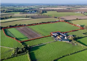
Our boundary surveys precisely determine property lines using advanced GPS technology. We research historical records and conduct field measurements to resolve disputes and support real estate transactions. Clients receive detailed documentation for legal protection and development planning.
Construction Staking
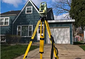
We provide accurate construction staking for buildings, roads, and utilities. Our team uses total stations and GPS to mark precise locations for contractors. This ensures proper alignment and compliance with design specifications during project execution.
Topographic Survey
Our topographic surveys map natural and man-made features with elevation data. This information supports site planning, drainage analysis, and environmental assessments. We deliver detailed contour maps and digital terrain models for engineering purposes.
ALTA Survey
We conduct ALTA/ACSM land title surveys meeting national standards. These comprehensive surveys identify easements, encroachments, and improvements for commercial property transactions. Clients receive title insurance-ready documentation with certified accuracy.
Drainage Design
Our civil engineers develop customized drainage solutions for residential and commercial sites. We analyze watershed characteristics and create detention systems to prevent flooding. Designs comply with local regulations and integrate with overall site development plans.
People
Brent A. Stringer
Land Surveyor
Licensed professional land surveyor with expertise in boundary resolution and construction staking. Active member of Indiana surveying associations, contributing to industry standards and mentorship programs.
Jonathan M. Isaacs
President
Licensed surveyor managing Brownstown operations with 20+ years of regional experience. Specializes in client relations and project coordination for complex land development projects.
Chad Leinart
Civil Engineer
Professional engineer overseeing Columbus office projects. Focuses on site design, drainage systems, and municipal infrastructure compliance for commercial developments.
Questions
What areas do you serve?
We provide surveying services throughout the entire state of Indiana from our Brownstown and Columbus offices.
What types of surveys do you perform?
We conduct boundary surveys, topographic surveys, ALTA surveys, construction staking, elevation certificates, and specialized surveys for residential and commercial projects.
Are your surveyors licensed?
Yes, all our surveyors are licensed professionals with the Indiana Society of Professional Land Surveyors.
How much does a land survey cost?
Costs vary by project size and complexity. Contact us for a free consultation and customized estimate.
Do you offer civil engineering services?
Yes, we provide complementary civil engineering services including site design, drainage planning, and construction management.
How long has your company been in business?
We've been serving Indiana since 1998, combining experience from three established local firms.