
Business Details
50+ Years
experience
Expert Land Surveying Services in Northbrook, IL
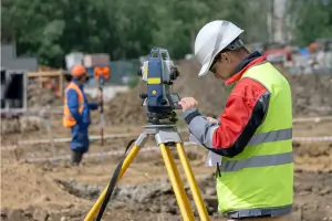
Founded in 1911, B.H. Suhr & Company has established itself as a trusted leader in land surveying services across the Chicagoland area. Our team of licensed professionals brings over 160 years of combined experience to residential, commercial, and governmental projects, ensuring precise boundary determinations and legal documentation. We specialize in ALTA/NSPS surveys, boundary analysis, topographic mapping, and construction staking, serving clients including real estate agents, attorneys, developers, and municipalities. Our extensive archive of field notes and commitment to modern surveying standards guarantees accurate, legally recognized plats of survey. As members of the Illinois Professional Land Surveyors Association and the National Society of Professional Surveyors, we uphold the highest industry standards.Our dedication to quality and client education ensures property owners understand the physical and legal characteristics of their land. With a legacy spanning more than a century, we continue to provide objective, expert analysis of land parcels through detailed measurements and legal research. Our services protect property rights and resolve encroachment issues, easement conflicts, and development challenges. By adhering to state-mandated protocols, we deliver reliable documentation that meets title insurance requirements and construction needs. Our Northbrook-based team remains committed to advancing surveying excellence while maintaining the integrity of our founding principles.


Services
ALTA/NSPS Surveys
Boundary Surveys
Topographic Mapping
Subdivision Plats
Construction Staking
Details
- Year established: 1911
Highlights and features
- Our team has over 160 years of combined surveying experience
- We specialize in ALTA/NSPS land title surveys for title insurance
- Licensed professionals perform legally recognized boundary determinations
- Maintain extensive historical field note archives for accurate research
- Committed to protecting property owners' rights through precise documentation
Associations and certifications
- Illinois Professional Land Surveyors Association (IPLSA)
- National Society of Professional Surveyors (NSPS)
Services
ALTA/NSPS Surveys
Our ALTA/NSPS land title surveys meet strict insurance requirements through comprehensive boundary analysis and legal document research. We identify easements, encroachments, and physical improvements to protect property investments. These detailed surveys satisfy lender and title company demands for commercial transactions.
Boundary Surveys
We determine property boundaries using precise field measurements and historical records. Our licensed surveyors create legal documents showing parcel dimensions, setback lines, and ownership markers. This service resolves boundary disputes and supports real estate transactions.
Topographic Mapping
Our topographic surveys document natural and man-made features with elevation data. These detailed maps guide construction planning, drainage analysis, and land development projects. We use advanced equipment to capture accurate terrain measurements.
Subdivision Plats
We prepare subdivision plats for creating new lots through legal parcel consolidation or division. Our services include boundary calculations, easement planning, and municipal approval documentation. This supports residential and commercial development projects.
Construction Staking
Our construction staking services mark building locations and infrastructure elements with precision. We provide grade stakes and foundation layout for accurate project implementation. This ensures proper alignment with approved plans and zoning requirements.
Questions
What types of surveys do you provide?
We offer ALTA/NSPS title surveys, boundary surveys, topographic mapping, subdivision plats, condominium plats, and construction staking services.
Why hire a licensed land surveyor?
State law requires licensed professionals to prepare legal survey documents. Our expertise ensures accurate boundary determinations and compliance with current standards.
How does a survey protect property owners?
Surveys identify encroachments, easements, and legal boundaries to prevent disputes. They're essential for real estate transactions and development projects.
Do you serve commercial clients?
Yes, we work with developers, attorneys, title companies, and municipalities on complex land transactions and development projects.
How long does a typical survey take?
Timelines vary by project complexity. Contact us for specific estimates based on your property's size and survey requirements.
Can you research historical property records?
Our extensive archive contains field notes and documents dating to 1911, supporting accurate boundary determinations through historical analysis.