
Business Details
Expert Geospatial Surveying Services in Marlette, MI
Muxlow Surveying is an experienced small business specializing in geospatial surveying and mapping services across Michigan and the Great Lakes Region. Our expertise spans local boundary surveys, transportation infrastructure, federal and state projects, energy sector initiatives, and commercial/industrial design surveying. Certified as a Woman-Owned Small Business (WOSB) and MDOT DBE, we maintain prequalification status with the Michigan Department of Transportation for right-of-way and road design surveys. Our team combines technical excellence with a commitment to client satisfaction, serving diverse clients from local residents to Fortune 500 companies and government agencies. We utilize advanced technologies including mobile LiDAR, UAV mapping, and photogrammetry to deliver precise data solutions.Our professionals hold industry certifications such as Certified Survey Technician (CST) levels I and IV, OSHA 40-hour HAZWOPER training, and American Heart Association CPR/AED credentials. We actively participate in humanitarian aid and social projects domestically and internationally. Our service areas include Michigan, Ohio, Indiana, Wisconsin, Minnesota, Kentucky, and adjacent regions through strategic partnerships. We maintain rigorous quality control standards while adapting to evolving industry requirements. Our team's combined experience ensures reliable execution of complex surveying challenges. Client testimonials highlight our precision, professionalism, and exceptional service delivery.
Services
Boundary Surveys
Geospatial Services
Transportation Surveys
Energy Surveys
Commercial Surveys
Hydrographic Surveys
UAV Mapping
Right of Way Surveys
Topographic Surveys
ALTA Surveys
Highlights and features
- We are a certified Woman-Owned Small Business (WOSB)
- Our team holds MDOT prequalification for critical surveying services
- We maintain OSHA-certified safety protocols for hazardous environments
- Our staff includes Certified Survey Technicians (CST) at multiple levels
- We combine technical expertise with humanitarian project experience
Associations and certifications
- WOSB
- MDOT DBE
- OSHA
- American Heart Association
What people say
Exceptional service delivery
Technical excellence
Reliable execution
Innovative solutions
Professional team
Services
Boundary Surveys
We conduct precise boundary surveys for residential, commercial, and governmental properties. Our services include property corner staking, easement creation, and legal description preparation. Utilizing advanced surveying equipment and techniques, we ensure accurate land division and boundary line adjustments that meet regulatory requirements.
Geospatial Services
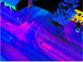
Our geospatial services employ LiDAR, photogrammetry, and UAV mapping technologies. We create detailed topographic maps, 3D models, and GIS data for infrastructure projects. These solutions support transportation planning, environmental assessments, and land development initiatives across multiple industries.
Transportation Surveys
We provide MDOT-certified road design surveys and right-of-way assessments. Our services include mobile LiDAR data collection, planimetric mapping, and runway design surveys. These transportation solutions support highway improvements, airport infrastructure development, and municipal road projects throughout Michigan.
Energy Surveys
Our energy sector services cover nuclear sites, wind farms, and transmission corridors. We perform subsidence monitoring, pipeline mapping, and facility surveys for energy infrastructure. These specialized surveys ensure safe and efficient operations for power generation and distribution facilities.
Hydrographic Surveys
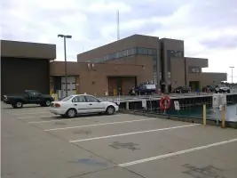
We conduct bathymetric surveys using manned and unmanned vessels. Our services include coastal erosion assessments, breakwall inspections, and underwater structure mapping. These hydrographic surveys support port maintenance, environmental monitoring, and infrastructure development along waterways.
People
Tricia Muxlow
President | CEO
Tricia Muxlow leads Muxlow Surveying with over 20 years of experience in geospatial services. She oversees project execution while maintaining technical excellence in boundary surveying and transportation mapping. Her leadership emphasizes innovation and client satisfaction.
Roberta Hardy
Office Manager | Project Coordinator
Roberta Hardy manages daily operations and project coordination. With extensive experience in surveying project management, she ensures efficient workflow and client communication. Her organizational skills support the company's diverse project portfolio.
Ron Meyer
Senior Crew Chief
Ron Meyer serves as Senior Crew Chief with CSTIV certification. He supervises field operations and technical implementation of surveying projects. His expertise in advanced surveying technologies contributes to the company's high-accuracy data collection standards.
Mark Lieber
Survey Technician
Mark Lieber performs field surveying tasks with specialized training in modern equipment operation. His technical skills support diverse projects including transportation infrastructure and energy sector mapping initiatives.
Tom Yaroch
Asset Security
Tom Yaroch manages asset security and equipment maintenance. His role ensures proper functioning of surveying instruments and protects company resources. His technical knowledge supports field operations and project continuity.
Questions
What surveying services does Muxlow offer?
We provide boundary surveys, geospatial mapping, transportation surveys, energy sector mapping, and hydrographic surveys using advanced technologies.
Are you certified for government projects?
Yes, we're MDOT prequalified, DBE-certified, and WOSB-accredited for state and federal transportation and infrastructure projects.
Which regions do you serve?
We operate throughout Michigan and the Great Lakes Region, with capabilities extending to Ohio, Indiana, Wisconsin, Minnesota, and Kentucky.
What technologies do you use?
We employ mobile LiDAR, UAV mapping, photogrammetry, and advanced GPS equipment for precise data collection and analysis.