Business Details
47 Years
experience
Professional Land Surveying Services in Portland, MI
Mulder & Associates Land Surveying has been serving Ionia County and surrounding areas with precision and dedication since 1979. Founded by Marinus 'Marty' Mulder and his wife Lucy, our family-owned business combines decades of experience with a commitment to excellence. Our team includes Professional Surveyor Ivan Maystead, who joined in 1982, and Office Manager Marcy Mulstead, ensuring seamless operations. As members of the Michigan Society of Professional Surveyors, we maintain the highest industry standards. With over 40 years of local expertise, we specialize in boundary surveys, topographic mapping, and FEMA certifications.Our licensed and insured professionals work closely with private individuals, commercial developers, and real estate professionals to deliver accurate, reliable results. We prioritize customer satisfaction through personalized service and technical proficiency. Our role as Ionia County representatives for the State Remonumentation Project since 1992 underscores our community commitment. Available Monday through Friday from 8:00 AM to 5:00 PM, we offer free estimates for all surveying needs. Trust our proven track record to handle your land surveying projects with precision and integrity.
Services
Boundary Surveys
Parcel Splits
Topographic Surveys
Mortgage Surveys
FEMA Certifications
GPS Surveys
Land Divisions
Site Condominiums
Details
- Year established: 1979
Highlights and features
- Family-owned with 40+ years of local surveying expertise
- Licensed and insured professional surveyors
- Free estimates for all land surveying needs
- Experienced with residential, commercial, and municipal projects
- Official Ionia County representatives for State Remonumentation Project
Services
Boundary Surveys
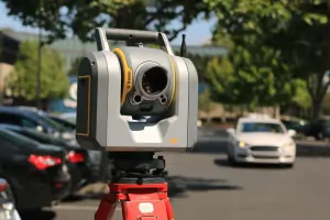
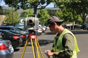
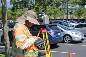
Our boundary surveys precisely determine property lines using advanced technology and historical records. This service helps resolve disputes, prepare for construction, or establish legal documentation. Our licensed professionals ensure compliance with Michigan surveying standards.
Topographic Surveys
We create detailed topographic maps showing natural and man-made features for development planning. This includes elevation contours, vegetation, and infrastructure. Our surveys support engineering and architectural projects with accurate terrain data.
FEMA Certifications
Our FEMA elevation certificates determine flood risk for insurance requirements. We measure building elevations relative to flood levels and provide documentation for floodplain management. This service helps property owners secure accurate flood insurance rates.
Parcel Splits
We assist with legal parcel division for property sales or development. This includes plat preparation, boundary analysis, and municipal compliance. Our team ensures proper documentation for county recorder offices during land subdivision processes.
GPS Surveys
Using GPS technology, we collect precise location data for large-scale mapping projects. This service supports infrastructure planning and environmental assessments. Our modern equipment improves accuracy while reducing field time for cost-effective solutions.
People
Marinus 'Marty' Mulder
Founder
Established the company in 1979 and serves as Ionia County representative for the State Remonumentation Project since 1992. Maintains active membership in the Michigan Society of Professional Surveyors.
Ivan Maystead
Professional Surveyor
Licensed surveyor with 40+ years of experience, joined the firm in 1982. Provides technical expertise for boundary determinations and mapping projects across Ionia County and surrounding areas.
Marcy Mulstead
Office Manager
Oversees daily operations and client communications. Manages administrative functions with 20+ years of experience in land surveying office management and project coordination.
Questions
What land surveying services do you offer?
We provide boundary surveys, topographic mapping, parcel splits, FEMA certifications, GPS surveys, and ALTA/ACSM land title surveys for residential and commercial clients.
Do you offer free estimates?
Yes, we provide free estimates for all land surveying and mapping services in Ionia County and surrounding areas.
How long have you been in business?
Mulder & Associates has served Michigan communities since 1979 with professional surveying services.
Are your surveyors licensed?
Yes, our professionals are licensed and insured surveyors with the Michigan Society of Professional Surveyors.
What areas do you serve?
We primarily serve Ionia County and surrounding Michigan areas from our Portland office location.