
Business Details
19 Years
experience
Expert Land Surveying Services in Maumee, OH
Established in 2007, Garcia Surveyors has built a reputation for excellence in land surveying through a combination of advanced technology, skilled professionals, and unwavering commitment to client satisfaction. Our team of seven licensed surveyors, supported by experienced CAD technicians and administrative staff, operates across multiple states, offering services ranging from UAV aerial surveys to GPS machine control. We prioritize meticulous research, consistent data transmission, and dependable fieldwork to deliver accurate results, leveraging hundreds of years of combined industry experience.Our investment in cutting-edge tools like photogrammetric measurements and 3D scanning ensures efficient, precise outcomes while maintaining core values of integrity and professionalism. Recognized through certifications including MBE/EDGE and DBE status, we serve municipal, industrial, and private clients with tailored solutions that meet evolving project demands.
Services
UAV Aerial Surveys
GPS Site Calibration
3D Scanning
ALTA Surveys
Environmental Surveys
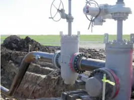
Pipeline Surveying
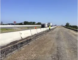
Transportation Infrastructure
Residential Surveys
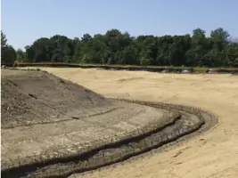
Industrial Layout
Machine Control
Details
- Year established: 2007
Highlights and features
- We offer 17+ years of specialized land surveying expertise.
- Our team includes seven licensed surveyors across multiple states.
- We utilize UAV drones and 3D scanning technology for precision.
- Certified MBE/EDGE and DBE by Ohio and Indiana DOTs.
- Proven track record with municipal and industrial infrastructure projects.
Associations and certifications
- Ohio Department of Transportation
- Indiana Department of Transportation
- Ohio Turnpike and Infrastructure Commission
- Avetta/PICS Safety Auditing
- ISNetworld Safety Compliance
- National Compliance Management Service
- Veriforce Compliance
What people say
Excellent quality
Responsive to deadlines
Depth in staffing
Highly recommend
Worked closely with staff
Services
UAV Aerial Surveys
Aerial photogrammetric measurements capture detailed site data for environmental assessments, topographic mapping, and as-built documentation. Our drones enable efficient inspection of hard-to-reach areas while maintaining high accuracy. Clients benefit from faster data collection and reduced field time for projects like infrastructure planning and land development.
3D Scanning
Fully surfaced point clouds and CAD models support architectural preservation, mechanical engineering, and construction projects. This technology captures millions of data points to create precise digital replicas. Clients use these models for design validation, historical restoration, and complex industrial measurements with millimeter-level accuracy.
Pipeline Surveying
Pipeline surveying services include route delineation, ROW mapping, and as-built documentation for new construction and maintenance. Advanced pipe-tracking systems ensure compliance with safety regulations. Clients receive comprehensive data for pipeline projects from initial planning through final inspection across Ohio and Indiana.
ALTA Surveys
ALTA/NSPS land title surveys meet strict industry standards for commercial property transactions. We provide boundary verification, easement identification, and improvement mapping to support title insurance. Clients receive detailed reports that satisfy lender and legal requirements for real estate deals.
GPS Site Calibration
GPS machine control systems guide earthwork and site preparation equipment for precise grading. Our calibration ensures construction projects meet design specifications. Clients achieve cost savings through reduced material waste and faster project completion for developments and infrastructure work.
People
Anthony A. (Tony) Garcia
Principal, President
Founder with over 17 years of leadership in land surveying, specializing in client relations and operational strategy. Licensed Professional Surveyor committed to advancing industry technology adoption while maintaining core values of integrity and precision.
Robert E. (Rob) Brazier
Principal & Manager of Roadway and Industrial Layout
Licensed surveyor with expertise in transportation infrastructure projects. Oversees complex roadway layout operations in Cleveland district, ensuring alignment with engineering specifications and regulatory standards for large-scale public works initiatives.
Daniel C. (Dan) Kaiser
Director of Surveys
Licensed Professional Surveyor managing field operations and quality control. Specializes in coordinating multi-disciplinary teams for industrial and municipal projects, ensuring adherence to safety protocols and technical accuracy across diverse geographic regions.
Douglas M. (Doug) Kuypers
Columbus Regional Manager
Licensed surveyor leading Columbus office operations with focus on project management and client coordination. Expertise in integrating scanning technology with traditional survey methods for infrastructure and environmental projects across central Ohio.
Eric Short
Cleveland Regional Construction Manager
Licensed Professional Surveyor specializing in construction-phase surveying. Manages field teams for Cleveland-area projects, ensuring precise implementation of design plans while addressing real-time challenges on active job sites.
Questions
What surveying services do you specialize in?
We specialize in UAV aerial surveys, 3D scanning, pipeline surveying, GPS machine control, and ALTA/NSPS title surveys for industrial, municipal, and private clients.
Are you certified for government projects?
Yes, we hold MBE/EDGE and DBE certifications from Ohio and Indiana DOTs, plus safety compliance registrations with Avetta/PICS and ISNetworld for public infrastructure work.
How do you handle large-scale projects?
Our team of seven licensed surveyors and CAD technicians uses advanced technology to manage complex projects, ensuring precise data collection and timely delivery for infrastructure and industrial clients.
What technology do you use?
We employ UAV drones, 3D laser scanning, GPS machine control systems, and photogrammetric software to deliver accurate, efficient surveying solutions for diverse project requirements.