Business Details
49 Years
experience
Professional Land Surveyors in Parma, Ohio
Since 1977, RM Kole & Associates has provided precise land surveying services across Ohio. Our second-generation family business began with traditional tools and a commitment to customer service, evolving into a technology-driven leader in boundary, topographic, and GPS surveys. We serve construction firms, utility providers, and private clients with accurate data collection using advanced equipment. Our team prioritizes clear client communication throughout every project. We guarantee satisfaction through detailed reporting and timely delivery.Based in Parma, we serve urban, suburban, and rural areas statewide. Our expertise includes ALTA surveys, construction staking, and legal descriptions. We maintain direct client access through live staff support during and after business hours. Our 45+ years of experience ensures reliable results for residential, commercial, and industrial projects. This dedication to quality and innovation has made us a trusted partner for hundreds of annual clients.

Services
ALTA Surveys
Utility Surveys
GPS Surveys
Industrial Surveying
Commercial Land Surveying
Boundary Surveys
Topographic Surveys
Site Plans
Construction Staking
Legal Descriptions
Details
- Year established: 1977
Highlights and features
- We have 45+ years of experience in Ohio land surveying
- Our team uses advanced GPS and data collection technology
- We maintain direct client communication throughout projects
- We offer comprehensive services from boundary surveys to legal descriptions
- Our quick response time handles urgent survey requests
Services
Boundary Surveys
Our boundary surveys precisely determine property lines using licensed measurements. This service helps prevent construction disputes for homeowners and contractors. We provide detailed reports that meet legal requirements for real estate transactions and development projects.
GPS Surveys
We utilize advanced GPS technology for accurate topographic mapping. This service creates detailed digital terrain models for construction planning and land development. Our GPS surveys improve project efficiency through precise elevation and feature documentation.
Construction Staking
Our construction staking services guide building projects with physical markers. We translate architectural plans into real-world coordinates for foundations and infrastructure. This ensures proper alignment and compliance with approved designs during development.
ALTA Surveys
We conduct ALTA/NSPS standard surveys for commercial property transactions. This service meets title insurance requirements with detailed boundary, easement, and improvement documentation. Our ALTA surveys provide lenders and buyers with comprehensive property information.
Topographic Surveys
Our topographic surveys map natural and man-made features with elevation data. This service supports drainage analysis and site planning for residential and commercial developments. We deliver detailed contour maps for engineering and architectural design purposes.
Questions
What areas do you serve?
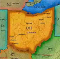
We provide surveying services throughout Ohio with our base in Parma. Our clients include Cleveland, Beachwood, and Hudson areas.
What survey types do you offer?
We offer boundary, topographic, ALTA, GPS, utility, and construction staking surveys among other specialized services.
How quickly can you complete a survey?
We prioritize quick response times and typically schedule urgent surveys within 24-48 hours of request.
Are your surveyors licensed?
Yes, our team consists of fully licensed and experienced Ohio land surveyors using professional-grade equipment.
How do you ensure accuracy?
We use modern GPS and data collection technology combined with traditional methods to verify measurements and documentation.
Can you handle commercial projects?
Yes, we serve construction companies, utility providers, and corporations with commercial surveying needs of all sizes.