Business Details
Your Trusted Partner for Land Surveying Solutions
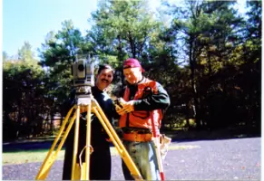
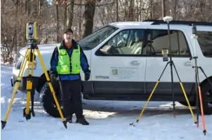
Horizon Land Development Services has dedicated itself to client satisfaction through quality land surveying and real estate development services across Wisconsin and Illinois. With over 25 years of experience as a licensed professional, the company specializes in residential, commercial, and retail land development projects of all sizes. Its expertise spans project management, land surveying, engineering principles, CAD drafting, stakeout techniques, and design. The team excels in due diligence site evaluations, leveraging digital GIS data to create conceptual plans before property purchase or engineering. A deep understanding of local ordinances and state statutes ensures efficient project completion with cost-effective solutions.Professional affiliations include the Wisconsin Society of Land Surveyors, National Society of Professional Surveyors, and the Greater Milwaukee Association of Realtors. The companys commitment to advanced technology, including Trimble surveying instruments, guarantees precision and reliability. Its track record includes high-profile projects like the Rocketship School Milwaukee conversion and infrastructure developments for Aurora Hospital. Fully licensed and insured, Horizon prioritizes transparency and client education. Its teams longevity and technical proficiency establish it as a trusted partner for complex land development challenges.
Services
Land Surveying
ALTA Surveys
Subdivision Plats
Topographic Surveys
Site Plans
FEMA Flood Mapping
Legal Descriptions
Utility Surveys
Construction Staking
GIS Data Compilation
Highlights and features
- We have over 25 years of experience in land surveying and development.
- Our team utilizes advanced Trimble surveying technology.
- We offer comprehensive due diligence site evaluations.
- Our expertise in local ordinances expedites project completion.
- Fully licensed and insured for client protection.
Associations and certifications
- Registered Land Surveyor, Wisconsin
- Professional Land Surveyor, Illinois
Services
Land Surveying
Horizon provides precise land surveying for property boundaries, subdivisions, and development projects. Using Trimble technology, we ensure accuracy for residential, commercial, and industrial clients. Our surveys comply with state and local regulations.
ALTA Surveys
ALTA/ACSM surveys meet national standards for property transactions. We deliver detailed maps showing boundaries, easements, and improvements, ensuring title insurance requirements are satisfied for commercial properties and lenders.
Subdivision Plats
We design and document subdivision plats for residential and commercial developments. Our process includes zoning compliance, utility layout, and regulatory approvals to streamline project execution.
Topographic Surveys
Topographic surveys capture natural and man-made features for engineering and design. We use GPS and GIS to create detailed elevation models, supporting site planning and construction projects.
Construction Staking
Our staking services guide construction accuracy by marking building corners, utilities, and infrastructure. We ensure designs translate precisely to the field, minimizing errors during development.
People
James R. Beaty
Managing Partner
James R. Beaty is a licensed land surveyor in Wisconsin (1985) and Illinois (2004) with over 25 years of experience. He specializes in land development, project management, and GIS data analysis.
Questions
What services does Horizon Land Development Services offer?
We provide land surveying, ALTA surveys, subdivision plats, topographic surveys, construction staking, and GIS data compilation for residential and commercial projects.
Do you serve areas outside Wisconsin and Illinois?
Our primary focus is Wisconsin and northern Illinois, though we may collaborate on select projects beyond these regions through partnerships.
Are your surveyors licensed and insured?
Yes, our team includes licensed professionals in Wisconsin and Illinois, and we maintain full insurance coverage for client protection.
How do you ensure survey accuracy?
We use Trimble surveying instruments and GPS technology, combined with decades of expertise, to guarantee precise measurements and compliance with industry standards.
Can you assist with project permitting?
Yes, we prepare documentation for zoning, wetland maps, and regulatory approvals to expedite permitting for land development projects.