
Business Details
50+ Years
experience
Emergency
services
Expert Geospatial Solutions for Infrastructure Projects
Aerial Services has been delivering high-quality geospatial solutions since 1967, specializing in aerial acquisition, LiDAR, GIS, and orthoimagery. As a Woman-Owned Small Business with over five decades of experience, we combine Midwest work ethic with cutting-edge technology to serve public and private sector clients nationwide. Our team of FAA-certified pilots, Lidar Scientists, GISPs, and photogrammetry specialists ensures data accuracy that exceeds national mapping standards.With rapid deployment capabilities and a fleet of fixed-wing aircraft, helicopters, and UAS, we provide tailored solutions for infrastructure planning, environmental monitoring, and emergency response. Our certifications with MAPPS, ASPRS, and ESRI partnerships underscore our commitment to industry leadership. We prioritize client satisfaction through transparent communication, rigorous quality control, and innovative approaches to complex geospatial challenges.
Services
Aerial Acquisition
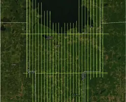
Corridor Services
GIS Mapping
LiDAR Surveys
Orthoimagery
UAS Solutions
Details
- Year established: 1967
Highlights and features
- 50+ years of geospatial data collection experience
- FAA-certified fixed-wing and UAS pilots
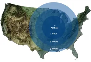
- Nationwide rapid response capabilities within 3 hours
- ESRI business partner for GIS integration
- Multi-level quality control exceeding national mapping standards
Associations and certifications
- MAPPS
- ASPRS
- GIS Certification Institute
- National Business Aviation Association
- ESRI
What people say
Impeccable quality
Timely service
Commitment to excellence
Highest quality delivery
Unmatched competency
Services
Aerial Acquisition
Our aerial acquisition services utilize advanced fixed-wing aircraft and helicopters to capture high-resolution geospatial data. We provide precise terrain mapping, vegetation analysis, and orthophotography for infrastructure planning and environmental monitoring. Our FAA-certified pilots ensure safe, efficient data collection across diverse landscapes.
LiDAR Surveys
Our LiDAR solutions create detailed 3D models using laser technology for accurate elevation measurements. Applications include terrain analysis, utility design, and floodplain evaluation. We process data to exceed national mapping standards with classifications for vegetation, buildings, and infrastructure.
GIS Mapping
We provide comprehensive GIS services integrating LiDAR and imagery data for mapping and spatial analysis. Our ESRI-certified specialists develop custom solutions for urban planning, asset management, and environmental monitoring. We offer data conversion, application development, and training services.
Orthoimagery
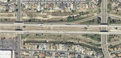
Our orthoimagery services deliver high-resolution RGB and near-infrared imagery for mapping applications. Using large-format cameras, we produce georeferenced images for land development, agriculture, and infrastructure projects with multiple spectral options.
UAS Solutions
Our Part 107-certified drone operators provide cost-effective surveys for smaller projects. We offer high-density LiDAR, orthoimagery, and 3D modeling for construction monitoring, infrastructure inspection, and topographic mapping with rapid turnaround times.
Questions
What geospatial services does Aerial Services offer?
We provide LiDAR, orthoimagery, GIS mapping, aerial acquisition, corridor solutions, and UAS services for infrastructure, utilities, and environmental projects.
How quickly can Aerial Services deploy for projects?
Our central location enables nationwide deployment within 3 hours of takeoff using fixed-wing aircraft, helicopters, or drones.
What industries do you serve?
We work with infrastructure, utilities, government agencies, agriculture, construction, environmental management, and renewable energy sectors.
How does Aerial Services ensure data accuracy?
We use calibrated equipment, perform multi-level quality checks, and employ certified professionals to exceed national mapping standards.
Can you handle emergency response projects?
Yes, our rapid deployment capabilities support disaster assessment for floods, fires, earthquakes, and other emergencies.