Business Details
24 Years
experience
Expert Land Surveyors in Montana
Montana Northwest has been delivering professional land surveying and consulting services to Montana and Idaho since 2002. With over 36 years of combined experience in Western Montana, our team specializes in land surveying, land use planning, water and sewer design, permitting, and land development. As lifelong residents deeply invested in the region's future, we combine local expertise with technical proficiency to serve private clients, government agencies, and municipalities. Our staff holds over 100 years of collective experience in surveying, CADD drafting, GIS mapping, and expert witness services. Equipped with advanced technology and five field crews, we handle projects ranging from boundary verification to complex subdivision planning.Licensed in Montana and Idaho, we maintain active memberships in professional organizations like the Montana Association of Professional Land Surveyors. Our commitment to quality and client satisfaction has earned us long-term partnerships with entities like the US Forest Service and Montana Department of Transportation. We operate from offices in Missoula and Anaconda, ensuring statewide accessibility. Our approach prioritizes precision, regulatory compliance, and budget-conscious solutions for every project.
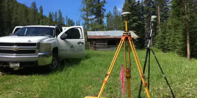
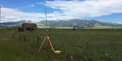
Services
Land Surveying
Subdivision Design
Boundary Surveys
Sanitation Permitting
Land Use Planning
Floodplain Mapping
ALTA Surveys
Topographic Mapping
Geodetic Control
Expert Witness Services
Details
- Year established: 2002
Highlights and features
- We have over 36 years of experience in Western Montana and Idaho
- Our team includes licensed Professional Land Surveyors in Montana and Idaho
- We maintain active memberships in professional organizations like MAPLS
- We operate with five fully equipped field survey crews
- We serve both private clients and major government agencies
Services
Land Surveying
Our professional land surveying services include boundary verification, property corner location, and ALTA surveys. Using advanced GPS and robotic equipment, we provide precise measurements for residential, commercial, and government projects. Our team handles complex cases involving PLSS corners and encroachment issues.
Subdivision Design
We specialize in subdivision design and review processes including zoning compliance and planned unit developments. Our services cover site mapping, utility planning, and sanitation design to meet local regulations while optimizing land use for developers and municipalities.
Sanitation Permitting
Our sanitation design services include percolation testing and septic permit acquisition. We work with homeowners and developers to create code-compliant wastewater solutions that meet environmental standards while considering site-specific geological conditions.
Floodplain Mapping
We provide floodplain elevation certificates and FEMA-related mapping services including LOMA and LOMR-F submissions. Our accurate topographic surveys help property owners and insurers assess flood risks and secure appropriate coverage.
Geodetic Control
Our geodetic control surveys use advanced Trimble equipment for high-accuracy positioning. This service supports large-scale infrastructure projects, boundary resurveys, and GIS data collection requiring millimeter-level precision across challenging Montana terrain.
People
Ken E. Jenkins
Founder and President
Licensed Professional Land Surveyor with 40+ years' experience in Montana and Idaho. Former president of MAPLS, expert witness in legal cases, and consultant for federal agencies including USFS and EPA.
Keith L. Brandt
Staff Surveyor
Crew chief with extensive cadastral survey experience. Specializes in boundary recovery and PLSS corner identification. Holds BS in landscape design from Montana State University with focus on site development surveying.
Michael R. Rice
Land Surveyor
LSI-certified surveyor with expertise in field operations and office drafting. Graduated from Montana State University with BS in Construction Engineering Technology and Minor in Land Surveying. Specializes in boundary and construction surveys.
Lynne M. Edens
Staff Planner
Office manager with 30+ years' experience in business administration and planning. Handles project coordination and client communications while maintaining active community involvement through 4-H and Chamber of Commerce programs.
Logan Schoening
Field Surveyor
Experienced field surveyor specializing in subdivision mapping and boundary surveys. Seventh-generation Montanan with deep knowledge of local terrain. Handles projects ranging from urban lot surveys to remote forest boundary work.
Questions
What land surveying services do you offer?
We provide boundary surveys, ALTA surveys, subdivision design, sanitation permitting, floodplain mapping, and geodetic control surveys for both private and government clients.
Are your surveyors licensed professionals?
Yes, our team includes licensed Professional Land Surveyors in Montana and Idaho with decades of combined experience in the region's unique terrain and regulations.
Do you work with government agencies?
Yes, we've completed projects for US Forest Service, Montana Department of Transportation, EPA, and local municipalities, understanding their specific requirements and documentation standards.
How quickly can you complete a survey?
Project timelines vary by complexity, but our five field crews and advanced equipment allow us to handle multiple projects simultaneously while maintaining quality and accuracy.
What technology do you use?
We utilize Trimble R10/R8 GNSS systems, robotic total stations, LIDAR control equipment, and TerraModel software for precise data collection and efficient project delivery.