
Business Details
19 Years
experience
Your Trusted Land Surveying Partner in Jacksboro, TX
Crowley Surveying has been a trusted provider of land surveying and pipeline services since 2007, serving civil, commercial, and residential clients across Texas. Our team combines cutting-edge technology with over 15 years of industry experience to deliver precise, efficient results tailored to each project's unique demands. We specialize in boundary surveys, ALTA/NSPS standards compliance, construction layout, and advanced 3D modeling using laser scanning and photogrammetry.Our client roster includes midstream and upstream oil and gas companies, civil engineers, and municipal authorities who rely on our expertise for complex land development and infrastructure projects. We maintain rigorous quality control through TBEPLS Firm Registration No. 10046500 while prioritizing clear communication and competitive pricing. Our rapid turnaround times ensure clients receive actionable data when they need it most, supported by a proven track record in both traditional and aerial surveying methodologies.
Services
Boundary Surveying
ALTA/NSPS Surveys
Construction Layout
Route Surveying
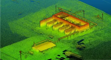
Laser Scanning
Aerial Photogrammetry
Topographic Surveying
Subdivisions & Platting
Details
- Year established: 2007
Highlights and features
- We utilize the latest surveying technology for accurate, efficient results
- Our team has over 15 years of specialized surveying experience
- We maintain TBEPLS registration for professional compliance
- We offer competitive pricing for all surveying services
- We deliver rapid turnaround times for time-sensitive projects
Associations and certifications
- TBEPLS
What people say
Exceptional service
Precision
The best in the field
Services
Boundary Surveying
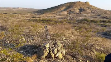
Our boundary surveys precisely define property lines, easements, and encroachments using advanced GPS technology. Clients receive detailed documentation meeting state regulations for real estate transactions, development projects, and legal dispute resolution. This service supports landowners, developers, and legal professionals requiring accurate property delineation.
ALTA/NSPS Surveys
We conduct comprehensive ALTA/NSPS land title surveys that meet strict industry standards for commercial real estate transactions. Our surveys identify encroachments, easements, and boundary details critical for title insurance purposes. Clients receive detailed reports that facilitate smooth property transfers and development planning.
Construction Layout
Our construction layout services establish precise site control points for building foundations, roadways, and infrastructure projects. Using robotic total stations and GPS equipment, we translate design plans into accurate field markings that guide construction teams. This ensures proper alignment and compliance with engineering specifications.
Aerial Photogrammetry
We employ drone-based photogrammetry to collect detailed topographic data for large areas. This technology creates orthophotos, 3D models, and point cloud datasets that support land development, pipeline routing, and environmental assessments with enhanced efficiency and accuracy.
Topographic Surveying
Our topographic surveys document natural and manmade features with elevation data for land planning and engineering design. Using traditional and laser scanning methods, we produce detailed terrain models that support drainage analysis, site development, and construction planning across diverse project types.
Questions
What surveying services do you offer?
We provide boundary surveys, ALTA/NSPS surveys, construction layout, route surveying, aerial photogrammetry, topographic surveys, and subdivision platting services.
How quickly can you complete a survey project?
Most projects are completed within standard industry timelines, with urgent requests accommodated when possible using our efficient field crews and processing systems.
What technology do you use for surveys?
We utilize robotic total stations, GPS systems, 3D laser scanners, and drone-based photogrammetry to ensure accurate, efficient data collection and processing.
Do you serve clients outside Jacksboro?
While based in Jacksboro, TX, we serve clients across Texas for various land surveying and pipeline projects requiring our specialized expertise.
How do you ensure survey accuracy?
Our TBEPLS-registered professionals follow strict quality control protocols using calibrated equipment and multiple verification methods to guarantee precise results.
Videos