
Business Details
7 Years
experience
Professional Land Surveying Services in Morrison, IL
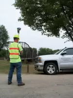
Norwest Surveying Services was established in 2019 by Jim Abbitt, leveraging his 45 years of expertise in surveying, construction, and development. Our team of nine professionals, including four crew chiefs and two licensed land surveyors, delivers precise and efficient land development services across Illinois and Iowa. We utilize cutting-edge technology like Real Time Kinetic GPS and maintain a database of over 10,000 projects to ensure accurate, research-driven solutions.Our services span boundary surveys, ALTA mapping, flood elevation certificates, and subdivision design, supported by partnerships with regional civil and architectural firms. We prioritize client collaboration, offering a one-stop shop for surveying, consulting, and construction services tailored to residential, commercial, and industrial projects.
Services
Boundary Surveys
ALTA Surveys
Topographic Mapping
Construction Staking
Flood Elevation Certificates
Subdivision Design
Easement Surveys
Geodetic Control Surveys
Parcel Line Amendments
Digital Terrain Modeling
Details
- Year established: 2019
Highlights and features
- We offer 45+ years of combined experience in surveying and development.
- Our team uses Real Time Kinetic GPS for high-accuracy results.
- We partner with regional civil and architectural firms for comprehensive solutions.
- Our database of 10,000+ projects ensures thorough research for every task.
- We provide one-stop services for surveying, consulting, and construction needs.
Services
Boundary Surveys
Boundary surveys establish property lines and corners using advanced GPS technology and historical records. Our team conducts thorough research and fieldwork to resolve disputes and ensure legal compliance. Clients receive detailed maps and documentation for residential, commercial, or industrial properties.
ALTA Surveys
ALTA/NSPS surveys provide comprehensive boundary and improvement details for commercial real estate transactions. We follow strict standards to identify easements, encroachments, and zoning requirements. Clients receive certified maps to support title insurance and development planning.
Topographic Mapping
Topographic surveys capture natural and man-made features to create detailed elevation models. We use digital terrain modeling for floodplain analysis, construction planning, and environmental assessments. Deliverables include contour maps and 3D visualizations for engineering and design projects.
Construction Staking
Construction staking ensures accurate placement of buildings, roads, and utilities using precise measurements. Our team collaborates with contractors to mark grades, utilities, and structural elements. Services support residential, commercial, and infrastructure projects from start to finish.
Flood Elevation Certificates
Flood elevation certificates document building elevations to determine flood risk and insurance requirements. We conduct field measurements and submit FEMA-compliant forms for residential and commercial properties. This service helps clients reduce insurance costs and meet regulatory standards.
People
Jim Abbitt
Owner, Professional Land Surveyor
Jim Abbitt has 45 years of experience in surveying, construction, and development. He founded Norwest Surveying Services in 2019, bringing expertise in ALTA surveys, subdivision design, and project management.
Scott Misfeldt
Professional Land Surveyor
Scott Misfeldt specializes in boundary surveys, geodetic control, and floodplain mapping. With decades of field and office experience, he ensures accuracy and compliance for complex land development projects.
Questions
What services does Abbitt Survey & Development offer?
We provide boundary surveys, ALTA/NSPS surveys, topographic mapping, construction staking, flood elevation certificates, subdivision design, and more for residential, commercial, and industrial clients.
How long has Abbitt Survey & Development been in business?
Abbitt Survey & Development was established in 2019 by Jim Abbitt, who has 45 years of experience in surveying and development.
In which states do you operate?
We are licensed to practice in Illinois and Iowa, serving clients across both states with local expertise and regional coverage.
What technology do you use for surveys?
We utilize Real Time Kinetic GPS and digital terrain modeling to ensure high-accuracy results and efficient data integration for every project.