
Business Details
Emergency
services
Engineering & Geospatial Services for Infrastructure
At SAM, we deliver fast, accurate geospatial data to empower clients with actionable insights for infrastructure projects. With national reach and local teams, we deploy advanced technologies like LiDAR, GIS, and BIM to support utilities, transportation, government, and natural resource sectors. Our expertise spans land surveying, aerial mapping, subsurface utility engineering, and construction monitoring, ensuring precision from project inception to completion. Founded on a culture of innovation and collaboration, we prioritize client success through tailored solutions and a commitment to safety and quality. Our 13 consecutive years of recognition in ENRs Top 500 Design Firms reflect our dedication to excellence. We specialize in transforming complex data into strategic assets, enabling informed decisions for sustainable infrastructure development.Our team of certified professionals combines technical proficiency with industry-specific knowledge to address challenges across electric power, telecommunications, highways, and more. By integrating digital twins and strategic GIS consulting, we future-proof projects against evolving demands. Recognized as a top workplace for fostering inclusion and professional growth, we invest in cutting-edge tools and talent to maintain our leadership in geospatial services. Whether managing multibillion-dollar programs or localized surveys, we deliver reliable data that drives confidence in every decision.
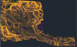

Services
Land Surveying
Aerial Mapping
GIS
BIM/3-D Laser Scanning
Survey/Construction Monitoring
Damage Prevention
3D Construction Inspection
Engineering Inspection
Powerline Inspection
FAC-008 Solutions
Highlights and features
- We deploy teams within 24 hours for urgent data collection needs.
- Our advanced technologies include high-density LiDAR and BIM/3D laser scanning.
- We offer expert consulting for strategic GIS and substation digital twins.
- Our teams have 13 consecutive years of recognition in ENRs Top 500 Design Firms.
- We specialize in subsurface utility engineering to minimize infrastructure risks.
Services
Land Surveying
Our land surveying services utilize cutting-edge technology to deliver precise measurements for infrastructure projects. We support route planning, boundary determination, and construction layout with high accuracy. Our expertise ensures compliance with regulatory standards and project specifications.
Aerial Mapping
Aerial mapping captures detailed geospatial data using LiDAR and high-resolution imagery. This service accelerates project timelines by providing comprehensive site analysis for transportation, utilities, and environmental applications. Data supports design, monitoring, and asset management.
GIS
GIS solutions integrate spatial data to enhance decision-making for infrastructure and resource management. We offer strategic consulting to develop digital twins and enterprise systems. Our work optimizes data visualization and analysis for utilities and government agencies.
Subsurface Utility Engineering
Subsurface utility engineering identifies underground infrastructure to mitigate risks during construction. We employ non-destructive methods to map utilities and coordinate with stakeholders. This service ensures safety and reduces project delays from unexpected conflicts.
Powerline Inspection
Powerline inspection services use aerial and ground-based technologies to assess transmission line integrity. We identify wear, vegetation encroachment, and structural issues to prevent outages. Our solutions enhance grid reliability and maintenance efficiency.
Questions
What geospatial services does SAM provide?
SAM offers land surveying, aerial mapping, GIS consulting, subsurface utility engineering, and powerline inspection services.
Which industries does SAM serve?
We support utilities, transportation, government agencies, and natural resource projects with geospatial data solutions.
How quickly can SAM deploy teams?
Our teams can mobilize within 24 hours to begin data collection for urgent projects.
Does SAM handle large-scale infrastructure projects?
Yes, we manage programs from localized surveys to multibillion-dollar transportation and energy initiatives.
What technologies does SAM use?
We employ LiDAR, BIM/3D laser scanning, GIS, and digital twin platforms for precise data capture and analysis.
Is SAM recognized for workplace culture?
Yes, we’ve been named a Top Workplace by Charlotte Magazine and Long Island Press for collaboration and innovation.