
Business Details
21 Years
experience
Trusted Land Surveying & Mapping Services in Houston
Pro Surv is a family-owned and operated land surveying company serving the Greater Houston area since 2005. Our founder, Tim Lesak, a Registered Professional Land Surveyor (RPLS) with industry experience since 1996, established our commitment to delivering surveys that meet Board standards while prioritizing efficiency and accuracy. We combine decades of collective experience with cutting-edge technology to ensure reliable results for residential and commercial clients. Our process streamlines survey delivery without compromising precision, and our teams expertise spans construction staking, elevation certificates, and complex subdivision projects.We pride ourselves on direct owner involvement, transparent communication, and a client-centric approach that has earned us trusted partnerships across Texas. Our reputation for quality work and service is built on consistent adherence to industry best practices and a focus on solving client challenges effectively.

Services
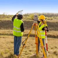
Construction Surveying
Platting/Re-Platting
Elevation Certificates
Topographic Surveying
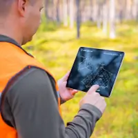
Tree Surveying
ALTA/ACSM Title Surveys
Right of Way Surveying
GPS/CORS Surveys
Deed Research
Engineering Support
Details
- Year established: 2005
Highlights and features
- We have over 20 years of experience in land surveying.
- Our team utilizes the latest technology for accurate results.
- We offer expedited delivery of surveys without compromising quality.
- Family-owned and operated with a commitment to client satisfaction.
- We serve the Greater Houston Area with local expertise.
What people say
Highly recommend
Professional and efficient
Quick turnaround
Fair pricing
Direct owner involvement
Services
Construction Surveying
Our construction surveying division handles all phases of development, from homebuilder lot pinning to road and utility staking for large-scale projects. We ensure precise alignment with design plans and regulatory requirements. Our three-phase surveys guarantee accuracy throughout the construction lifecycle, supporting both residential and commercial clients.
Elevation Certificates
We provide FEMA-certified elevation certificates to determine flood insurance rates and compliance. These documents help property owners understand flood risks and potentially reduce insurance costs. Our surveys meet federal standards and are completed with rapid turnaround times for urgent needs.
Topographic Surveying
Our topographic surveys map natural and man-made features for construction, permitting, and development projects. We capture elevation data, contours, and site details to support engineering and architectural plans. Clients receive detailed digital and printed deliverables for precise project execution.
Tree Surveys
Tree surveys identify protected and removable trees per local ordinances. We measure caliper sizes and locations to guide development while meeting environmental regulations. Our reports help clients avoid fines and streamline permitting for subdivisions and new construction.
ALTA/ACSM Title Surveys
We conduct ALTA/ACSM-compliant boundary surveys for commercial real estate transactions. These detailed surveys verify legal descriptions, easements, and encroachments. Our work supports title insurance requirements and ensures clear property lines for developers and lenders.
People
Tim Lesak
Owner & RPLS
Tim Lesak, a Registered Professional Land Surveyor with over 25 years of experience, founded Pro Surv in 2005. He oversees all operations, ensuring adherence to industry standards and client satisfaction. His expertise spans residential and commercial surveying, with a focus on precision and efficiency.
Questions
What services does PRO-SURV offer?
We provide construction surveying, elevation certificates, topographic mapping, tree surveys, ALTA/ACSM title surveys, and more for residential and commercial clients.
Do you serve areas outside Houston?
We serve the Greater Houston Area, including Brazoria, Chambers, Fort Bend, Galveston, Montgomery, Harris, Liberty, San Jacinto, and Wharton counties.
How quickly can you complete a survey?
Our streamlined process typically delivers surveys within 5-7 business days, with expedited options available for urgent projects.
Are your elevation certificates FEMA-approved?
Yes, all our elevation certificates meet FEMA requirements and are accepted for flood insurance purposes.
Can you handle large subdivision projects?
Yes, we specialize in platting, re-platting, and boundary surveys for large-scale developments and subdivisions.