Business Details
46 Years
experience
Your Trusted Land Surveying Partner in Santa Fe
Founded in 1980, Dawson Surveys has established itself as a premier land surveying firm serving clients across the United States and Canada. Our expertise spans boundary surveys, construction staking, GIS mapping, and specialized projects requiring precise deformation monitoring. With offices in Santa Fe, New Mexico, and Covington, Louisiana, we operate under licenses in Arizona, Colorado, Georgia, Louisiana, Texas, and British Columbia. Our team of licensed surveyors and technicians utilizes advanced tools like Land Desktop Development and Carlson Survey to deliver accurate results for residential, commercial, and public works projects. We maintain affiliations with the North Central Chapter NMPS and the American Congress on Surveying and Mapping, underscoring our commitment to industry standards.Our founder, Gary Edward Dawson, brought decades of experience from Alberta and British Columbia to build a company renowned for technical excellence and courtroom-tested reliability. We prioritize client collaboration, employing real-time GPS and conventional methods to meet project-specific needs efficiently. Our work on landmarks like Las Campanas and the Santa Fe River Trail demonstrates our capacity for large-scale, complex assignments. With a legacy rooted in precision and professionalism, we continue to serve as trusted partners in land development and infrastructure projects.
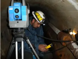
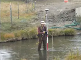
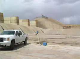
Services
Boundary Surveys
Construction Staking
GIS Mapping
Subdivision Platting
Aerial Photo Control
Right of Way Mapping
Deformation Monitoring
ALTA Surveys
Public Land Retracements
Topographic Mapping
Details
- Year established: 1980
Highlights and features
- We offer 40+ years of experience in complex land surveying projects.
- Our team holds licenses in six U.S. states and Canada.
- We utilize advanced GPS and CAD technologies for superior accuracy.
- Our surveys are courtroom-tested and legally defensible.
- We maintain long-term partnerships with major engineering firms.
Services
Boundary Surveys
We conduct precise boundary surveys to establish property lines for residential and commercial developments. Our team uses GPS and conventional equipment to meet legal requirements, ensuring accurate land division for projects like Las Campanas. This service provides legally defensible documentation for real estate transactions and disputes.
Construction Staking
Our construction staking services guide infrastructure projects with millimeter-level accuracy. We collaborate with engineers and contractors to mark building placements, utilities, and roadways. This ensures compliance with design plans for developments like the Buffalo Thunder Casino, minimizing costly rework during construction phases.
GIS Mapping
We create detailed GIS maps for public utilities and private clients using field data and aerial imagery. This service supports infrastructure planning and asset management, as demonstrated in our sewer system mapping for Santa Fe's CIP 910 project. Our work integrates with client workflows for long-term utility maintenance.
Aerial Photo Control
We establish ground control points for aerial mapping projects, ensuring image accuracy for large areas. This service supported the Santa Fe River Trail's phase I and II mapping as a subcontractor. Our work enables precise topographic analysis for environmental and infrastructure planning.
Deformation Monitoring
We perform high-precision deformation surveys to track structural movements in buildings and infrastructure. This service detects subtle shifts over time, providing critical data for safety assessments and maintenance planning. Our methods combine traditional and modern technologies for reliable long-term monitoring.
People
Gary Edward Dawson
Founder
Licensed surveyor with 60+ years of experience, established Dawson Surveys in 1980 after practicing in Alberta and British Columbia. Recognized for technical expertise and courtroom testimony capabilities.
Edward M. Trujillo
Experienced surveyor managing field operations in New Mexico, specializing in public works projects and boundary retracements using advanced GPS technology.
Diego J. Sisneros
Licensed technician proficient in CAD software and field surveys, supporting residential and commercial projects with precise data collection and mapping solutions.
Barry S. Phillips
Dual-role surveyor handling both fieldwork and office calculations, with expertise in subdivision platting and construction staking for large-scale developments.
Scott Meredith
Specialist in communication facility surveys for Pathfinder Surveys, conducting FAA-certified tower surveys across domestic and international locations.
Questions
What geographic areas do you serve?
We operate in Arizona, Colorado, Georgia, Louisiana, Texas, New Mexico, and British Columbia, with primary offices in Santa Fe and Covington.
What surveying technologies do you use?
We employ real-time GPS, static GPS, total stations, leveling equipment, and CAD software like Carlson Survey for optimal accuracy and efficiency.
Are your surveys legally defensible?
Yes, our licensed surveyors provide court-tested boundary determinations and maintain strict compliance with state-specific legal requirements.
Can you handle large-scale development projects?
We've completed surveys for major developments including Las Campanas, Rancho Viejo, and the Buffalo Thunder Casino, demonstrating our capacity for complex assignments.
Do you work on public infrastructure projects?
Yes, we've provided right-of-way mapping for Santa Fe's sewer projects and aerial control for the Santa Fe River Trail in partnership with municipal agencies.
How do you ensure survey accuracy?
We combine advanced technology with licensed professionals' expertise, using multiple equipment types per project to verify measurements and minimize error margins.