Business Details
Expert Land Surveying & Engineering Services in Coeur d'Alene
H2 Engineering Surveying is a full-service firm dedicated to delivering innovative and cost-effective land surveying and engineering solutions. With over 30 years of collective experience, our team of licensed professionals operates across Idaho, Washington, Oregon, Montana, and Arizona, offering specialized services as Certified Federal Surveyors. Our commitment to technical excellence is supported by advanced technology, including GPS equipment, state-of-the-art software, and automated monitoring systems tailored to project-specific needs. We prioritize operational efficiency through robust project management tools, ensuring quality work is completed on time and within budget. Our personnel are trained in the latest methodologies, enabling us to handle complex projects with strict tolerances, such as those for the Army Corps of Engineers and major infrastructure developments.Client satisfaction drives our approach, combining flexibility, technical expertise, and a deep understanding of regional and federal requirements. We serve diverse industries, including transportation, energy, and telecommunications, with a focus on precision and reliability. Our work includes boundary surveys, topographic mapping, construction staking, and high-profile federal projects requiring exacting standards. By maintaining certifications and fostering a culture of continuous improvement, we position ourselves as a trusted partner for surveying and engineering challenges.
Services
Aerial Mapping
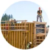
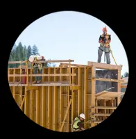
Construction Staking
ALTA Surveys
Elevation Certificates
Bathymetric Surveys
Hydrographic Surveys
Boundary Surveys
Scanning Projects
Subdivision Plats
Topographic Surveys
Highlights and features
- We have over 30 years of collective surveying experience across five states.
- Our team includes federally certified surveyors with expertise in strict-tolerance projects.
- We utilize advanced GPS and monitoring systems for accuracy and efficiency.
- Our project management tools ensure timely delivery within budget constraints.
- We serve diverse industries, including federal agencies and Fortune 500 companies.
Associations and certifications
- Certified Federal Surveyor (CFedS)
Services
Boundary Surveys
Boundary surveys establish property lines and legal descriptions using historical records and precise measurements. Our team resolves disputes and ensures compliance with state and federal regulations. Clients rely on our expertise for real estate transactions, development projects, and federal land assessments.
Construction Staking
Construction staking guides infrastructure projects by marking precise locations for buildings, roads, and utilities. We use advanced GPS technology to meet strict tolerances required for highways, bridges, and industrial facilities. Our work ensures alignment with design plans and minimizes costly errors.
Topographic Surveys
Topographic surveys create detailed maps of natural and man-made features for engineering and design purposes. We provide elevation data and 3D models to support land development, mining, and environmental projects. Our deliverables meet FAA and federal agency standards.
Automated Monitoring
Automated monitoring systems track movements in structures, slopes, and tunnels using robotic stations and real-time data analysis. Clients receive alerts for displacements exceeding tolerances, ensuring safety and preventing damage. This service is critical for mines, dams, and large-scale infrastructure.
ALTA Surveys
ALTA surveys meet national standards for commercial real estate transactions. We identify property boundaries, easements, and improvements to mitigate legal risks. Our surveys comply with title insurance requirements and are trusted by developers, lenders, and federal agencies.
People
Heath Hartwig
Managing Member
Heath Hartwig founded H2 Engineering Surveying and oversees boundary surveys, platting, and topographic design. With licenses in Washington and North Dakota, he specializes in project coordination and digital terrain modeling for complex infrastructure projects.
Josh Bagley
Survey Manager
Josh Bagley, a Certified Federal Surveyor, leads H2's survey team with 19 years of experience in boundary surveys and construction staking. Licensed in five states, he ensures compliance with federal standards for high-profile projects across the Northwest.
Randy Hamilton
Civil Engineer
Randy Hamilton provides civil engineering expertise for land development and infrastructure projects. Licensed in Idaho, Montana, and Washington, he focuses on stormwater management, road design, and construction surveying to support H2's engineering deliverables.
Questions
What services does H2 Surveying & Engineering offer?
We specialize in boundary surveys, construction staking, topographic mapping, ALTA surveys, automated monitoring, and federal-certified projects for infrastructure, energy, and transportation sectors.
Which states do you operate in?
We are licensed to serve Idaho, Washington, Oregon, Montana, and Arizona, with expertise in federal projects across the United States.
Are you certified for federal surveying projects?
Yes, we are Certified Federal Surveyors (CFedS) with experience on projects for the Army Corps of Engineers and other federal agencies.
How do you ensure accuracy for strict-tolerance projects?
We use advanced GPS technology, robotic monitoring systems, and rigorous quality control processes to meet exacting standards for federal and industrial clients.
What industries do you work with?
We serve transportation, energy, telecommunications, mining, and government sectors, providing tailored surveying and engineering solutions for complex projects.