Business Details
24 Years
experience
Expert Aerial Mapping Services in Phoenix, AZ
AeroTech Mapping, Inc. is a leading aerial mapping provider known for blending experience, dedication, and innovation. Founded in 2002, we have completed over 16,000 projects across the Southwest, serving private sector clients and public agencies. Our team includes ASPRS-certified photogrammetrists, FAA-certified pilots, and licensed land surveyors in multiple states. We invest heavily in state-of-the-art equipment, including owned Cessna 206 aircraft and advanced LiDAR systems, to ensure precision and flexibility. Our process prioritizes on-time delivery, with a company motto of 'On Time, Every Time.' We provide high-quality geospatial products, from digital orthophotography to bathymetric surveys, tailored to meet client needs.Our reputation is built on technical excellence, client collaboration, and a commitment to exceeding expectations. With offices in Phoenix, Tucson, Las Vegas, and other Southwest locations, we combine local expertise with nationwide capabilities. Our certifications, including DBE and SBE status in multiple states, reflect our dedication to industry standards. Client testimonials highlight our professionalism, accuracy, and ability to deliver complex projects efficiently.
Services
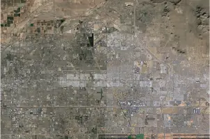
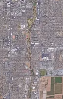
Airborne photogrammetry
Photogrammetric mapping
Digital orthophotography
UAV mapping
Bathymetric surveying
LiDAR data collection
Details
- Year established: 2002
Highlights and features
- We have 20+ years of experience in aerial mapping and geospatial services.
- Our team includes ASPRS-certified photogrammetrists and FAA-certified pilots.
- We own and operate Cessna 206 aircraft for reliable data collection.
- We guarantee on-time delivery with advanced project management systems.
- Our LiDAR and UAV technology ensures high-resolution, accurate mapping products.
Associations and certifications
- ASPRS (American Society for Photogrammetry and Remote Sensing)
- FAA (Federal Aviation Administration)
- Arizona Unified Certification Program (AUCP)
- California Unified Certification Program (CUCP)
- Nevada Unified Certification Program (NUCP)
- Texas Department of Transportation (TxDOT)
What people say
Professional, accurate
Exceed expectations
Reliable product
Unlimited access to experts
Seamless integration with design
Services
Airborne photogrammetry
We use Cessna 206 aircraft equipped with Vexcel Ultracam Falcon and Phase One iXM-RS280F cameras for high-resolution aerial data collection. Our dual imagery and LiDAR systems enable efficient, accurate mapping for large-scale projects. This technology reduces outsourcing risks and ensures timely delivery of geospatial data.
LiDAR data collection
Our Teledyne Galaxy LiDAR systems capture detailed 3D terrain models with single-pass point density. Applications include floodplain mapping, forest management, and infrastructure analysis. We integrate LiDAR with UAV and terrestrial data for comprehensive site models.
UAV mapping
DJI Matrice 300 drones with Zenmuse H20N payloads provide high-resolution data in challenging environments. We use UAVs for steep terrains, construction sites, and hazardous areas while maintaining safety and accuracy. Data integrates seamlessly with manned aircraft collections.
Photogrammetric mapping
Certified photogrammetrists create digital terrain models and planimetric features using DAT/EM Summit Evolution software. We refine breaklines for roadways and waterways to produce precise mapping products under direct supervision of ASPRS-certified professionals.
Bathymetric surveying
SeaFloor HyDrone technology quantifies sediment deposition in reservoirs and mine pits. We combine LiDAR, UAS, and terrestrial data with underwater surveys to create comprehensive models for erosion monitoring and infrastructure design.
People
Teresa Torres
CFO, Principal & Founding Partner
With 32 years in photogrammetry, Teresa manages company finances and co-founded AeroTech Mapping. She combines industry expertise with charitable work and golfing passion.
Leo Torres
VP, Principal & Founding Partner
A 31-year geospatial veteran, Leo leads operations and client relations. He balances hands-on management with outdoor activities like golf and cycling in Las Vegas.
Mike Grossman
Director of Flight Operations - Chief Pilot
With 25 years and 13,000 flight hours, Mike oversees flight operations and project management. He enjoys running, cycling, and hosting social events outside work.
Eric Phan
General Manager, Las Vegas
A certified photogrammetrist and licensed surveyor in three states, Eric brings 20 years of technical expertise to AeroTech's Las Vegas operations.
Joey Desjardins
Business Development
With seven years in geospatial sales, Joey drives client relationships across government and private sectors. He focuses on seamless project delivery from scoping to completion.
Questions
What services does AeroTech Mapping offer?
We provide aerial photogrammetry, LiDAR data collection, UAV mapping, digital orthophotography, and bathymetric surveys for infrastructure and environmental projects.
How long has AeroTech Mapping been in business?
We have completed over 16,000 projects since our founding in 2002, serving clients across the Southwest and beyond.
What technology does AeroTech Mapping use?
We utilize Cessna 206 aircraft, Teledyne Galaxy LiDAR systems, DJI Matrice 300 UAVs, and advanced software like Trimble Inpho for precise data collection.
Do you work with public and private sector clients?
Yes, we partner with both private engineering firms and public agencies on transportation, land development, and infrastructure projects.
How do you ensure project accuracy?
Our ASPRS-certified photogrammetrists and licensed surveyors use state-of-the-art equipment and rigorous quality control processes for all deliverables.
Are you certified for government contracts?
We hold DBE, SBE, and HUB certifications in multiple states, including Arizona, California, Nevada, and Texas.