Business Details
8 Years
experience
Expert Land Surveying Services
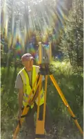
At Washburn Land Surveying, we combine extensive industry knowledge with a passion for precision to deliver comprehensive surveying, mapping, and measurement services. Our team specializes in construction layout, boundary resolution, topographic design, and UAV/drone aerial mapping, serving diverse environments from mountainous regions to urban centers. With licenses in Colorado, Idaho, and Wyoming, we prioritize timely project completion to support client deadlines. Our commitment to quality is reinforced by technical oversight, advanced equipment, and adherence to rigorous quality control standards.We serve commercial developers, residential builders, and energy sector clients, including major oil and gas companies. Our principals bring civil engineering expertise and MBA-level business acumen to ensure operational excellence. By integrating FAA-certified drone technology with traditional surveying methods, we enhance data accuracy and project efficiency. Client satisfaction remains central to our operations, reflected in long-term partnerships built on integrity and reliable service delivery.

Services
Construction Surveying
Boundary Surveys
Topographic Mapping
Oil & Gas Surveys
UAV Aerial Mapping
ALTA Surveys
Details
- Year established: 2018
Highlights and features
- We offer 20+ years of combined experience in complex land surveying projects
- Our FAA-certified drone pilots enhance mapping accuracy and efficiency
- Licensed professionals operating in Colorado, Idaho, and Wyoming
- Technical oversight ensures adherence to industry-leading quality standards
- Proven track record with major energy companies like PDC Energy
Services
Construction Surveying
We provide precise construction layout services for commercial sites, residential developments, and infrastructure projects. Our surveyors ensure accurate grade staking and alignment to support building foundations, utilities, and roadways. By maintaining strict tolerances, we help contractors meet project specifications and deadlines.
Boundary Surveys
Our boundary surveying services resolve property disputes and establish legal land descriptions. We conduct title research, monument identification, and GPS measurements to create ALTA/NSPS compliant surveys. Clients receive detailed plat maps for real estate transactions and development planning.
UAV Aerial Mapping
We deploy FAA-certified drone pilots to capture high-resolution aerial data for land mapping. This technology creates detailed topographic models and orthomosaic imagery. Clients benefit from faster data collection and reduced field time compared to traditional methods.
Oil & Gas Surveys
Our team supports energy companies with well pad layout, pipeline routing, and lease boundary verification. We've completed hundreds of oil & gas projects for operators like EnCana and Crestone Peak Resources. Surveys ensure regulatory compliance and efficient resource development.
Topographic Surveys
We create detailed topographic maps showing natural and man-made features for engineering and design purposes. Using robotic total stations and GPS equipment, we capture elevation data and surface contours. These surveys support drainage analysis, site planning, and construction documentation.
People
Chad Washburn
Principal
PLS licensed in CO, ID, and WY with expertise in route surveying and land development. Holds Civil Engineering Technology degree from Idaho State University and MBA from University of Colorado.
Andy Shellenbarger
Principal
Provides technical oversight for survey operations. Specializes in construction layout and boundary surveying. Pursuing PLS license with experience in UAV technology and quality control procedures.
Questions
What surveying services do you offer?
We provide construction surveying, boundary resolution, topographic mapping, oil & gas surveys, and UAV drone mapping services.
Which states are you licensed in?
Our professionals hold licenses in Colorado, Idaho, and Wyoming for land surveying operations.
Do you work on oil & gas projects?
Yes, we've completed surveys for hundreds of energy sites including clients like PDC Energy and EnCana.
How does drone technology benefit surveys?
UAVs enable faster data collection, reduced costs, and high-resolution aerial mapping for large areas.
How do you ensure survey accuracy?
We use modern equipment, implement quality control checks, and maintain licensed professional oversight for all projects.
What construction projects do you support?
We handle residential, commercial, and infrastructure projects including site layout, grading, and utility alignment surveys.