
Business Details
Emergency
services
Expert Geospatial Services for Infrastructure Projects Nationwide
At SAM, we deliver fast, accurate geospatial data to empower clients to advance infrastructure projects with confidence. With national reach and local teams, our experts deploy advanced technologies like LiDAR, GIS, and BIM to collect, analyze, and architect data into actionable insights. Our 24-hour mobilization capability ensures rapid response for land surveys, construction monitoring, and digital twin development. We specialize in utility coordination, subsurface engineering, and powerline inspections, serving utilities, transportation, government, and energy sectors. Backed by 13 consecutive years on ENRs Top 500 Design Firms list, we combine technical expertise with a culture of innovation and inclusion.Our strategic consulting helps clients minimize risks, optimize asset management, and future-proof infrastructure. Recognized as a Top Workplace in Charlotte and Long Island, we prioritize employee engagement and technological advancement. From aerial mapping to FAC-008 compliance solutions, we turn complex spatial challenges into strategic advantages. Our ACEC National Recognition Award underscores our commitment to excellence in projects like the TxDOT El Paso Border Highway Study. With offices across the U.S., including Texas and New York, we provide tailored geospatial services that meet rigorous industry standards.

Services
Land Surveying
Aerial Mapping
GIS
BIM/3D Laser Scanning
Damage Prevention
3D Construction Inspection
Engineering Inspection
Powerline Inspection
Substation Digital Twins
Subsurface Utility Engineering
Highlights and features
- National reach with local teams enabling rapid 24-hour deployment
- Advanced technologies like LiDAR, GIS, and BIM for precise data capture
- 13 consecutive years ranked on ENRs Top 500 Design Firms list
- Specialized expertise in FAC-008 compliance and subsurface utility engineering
- Award-winning safety and risk management protocols for infrastructure projects
Associations and certifications
- American Council of Engineering Companies (ACEC)
Services
Land Surveying
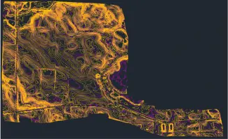
SAMs land surveying services utilize high-precision GPS and LiDAR to create detailed topographic maps for infrastructure planning. Our teams deliver accurate boundary determinations, elevation models, and site analysis to support construction, utilities, and transportation projects. With rapid 24-hour mobilization, we ensure timely data collection for clients nationwide.
Aerial Mapping
Our aerial mapping solutions employ drones equipped with LiDAR and multispectral cameras to capture large-area geospatial data. This technology enables efficient corridor mapping for highways, pipelines, and powerlines while reducing field time. Clients receive high-resolution orthomosaics and 3D models for asset management and environmental assessments.
Subsurface Utility Engineering
SAMs SUE services identify and map underground utilities using ground-penetrating radar and electromagnetic detection. We classify utilities to ASCE 38-02 standards, minimizing risks during excavation. Our solutions integrate with GIS platforms to provide clients with actionable subsurface data for safe, code-compliant project execution.
Powerline Inspection
Our powerline inspection services combine aerial LiDAR and thermal imaging to assess transmission line integrity. Advanced analytics detect vegetation encroachment, conductor wear, and structural defects. Utilities receive prioritized maintenance recommendations to enhance grid reliability and comply with FAC-008 standards.
BIM/3D Laser Scanning
SAMs 3D laser scanning creates as-built BIM models for infrastructure and industrial facilities. Point cloud data captures millimeter-level accuracy, enabling clash detection and construction sequencing. Clients leverage these digital twins for lifecycle asset management, retrofit planning, and facility operations optimization.
Questions
What industries does SAM serve?
We support utilities, transportation, government agencies, and energy sectors with geospatial solutions for infrastructure development and asset management.
How quickly can SAM deploy for emergency projects?
Our teams mobilize within 24 hours to begin data collection for urgent infrastructure assessments and disaster recovery efforts.
What technologies does SAM use for data collection?
We employ LiDAR, GIS, BIM, drones, and ground-penetrating radar to deliver high-accuracy geospatial data across projects.
Does SAM offer nationwide services?
Yes, with local offices in Texas, New York, and North Carolina, we provide nationwide coverage for geospatial and surveying needs.
How does SAM ensure data accuracy?
Our certified professionals follow rigorous quality control protocols and industry standards like ASCE 38-02 for subsurface utility engineering.