Business Details
46 Years
experience
Global Geophysical Survey Solutions
MWH Geo-Surveys has been pioneering geophysical exploration for over 40 years, delivering high-quality data in challenging environments worldwide. Our team combines innovative modern technologies with proven methodologies to provide precise exploration targets for resource clients. With decades of experience in remote project locations, we specialize in safe, efficient, and accurate survey operations. Our expertise spans UAV-based gravity, magnetic, and radiometric surveys, supported by proprietary software and cutting-edge equipment. We prioritize centimeter-level precision in GNSS positioning and offer tailored solutions for mineral exploration, environmental monitoring, and geological mapping.Our commitment to technological advancement ensures rapid data acquisition and processing, even in the most demanding terrains. Operating globally while maintaining local service standards, we collaborate with clients to address complex geophysical challenges. Our history of successful projects across five continents underscores our reputation for reliability and technical excellence. All operations adhere to strict safety protocols and regulatory compliance, ensuring client satisfaction through actionable insights. With offices in Canada and the U.S., we provide scalable solutions for projects of any size or complexity.
Services
Ground Gravity Surveys
UAV Magnetics
UAV Radiometrics
UAV Terrain Modeling
GNSS Positioning
Details
- Year established: 1980
Highlights and features
- We have conducted over 80,000 line kilometers of UAV magnetic surveys globally.
- Our proprietary GControl software enables real-time data analysis and quality control.
- We operate dual BGO crystal UAV gamma-ray spectrometers for advanced radiometric mapping.
- Our team has decades of experience in remote geophysical operations across five continents.
- We utilize laser-pumped cesium vapor magnetometers for ultra-high sensitivity measurements.
Services
Ground Gravity Surveys
We conduct high-resolution gravity surveys using advanced electronic feedback meters and proprietary GControl software. Our centimeter-level GNSS positioning ensures precise data collection for mineral exploration and subsurface analysis. This service provides critical insights for resource industries operating in complex geological environments.
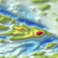
UAV Magnetics
Our UAV magnetic surveys utilize laser-pumped cesium vapor magnetometers for ultra-sensitive field detection. Industrial-grade drones collect high-resolution data in rugged terrains, offering superior accuracy compared to traditional helicopter surveys. This technology identifies magnetic anomalies for mineral exploration and geological mapping.
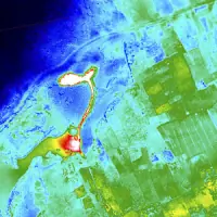
UAV Radiometrics
We deploy UAV-mounted gamma-ray spectrometers to map radioactive elements for mineral exploration and environmental monitoring. Dual-crystal sensors provide detailed radiometric data in challenging terrains. This service supports geothermal exploration and geological mapping with real-time data processing capabilities.
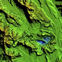
UAV Terrain Modeling
Our UAV photogrammetry systems create ultra-high-resolution digital surface models for GIS applications. PPK VTOL drones capture detailed topographic data, which integrates with magnetic surveys for low-altitude terrain-following missions. This service supports site planning and geological analysis with thermal radiometric options.
GNSS Positioning
We provide centimeter-accurate GNSS positioning using multi-constellation dual-frequency receivers. This service enhances gravity and magnetic survey precision through real-time kinematic corrections. Our equipment supports rapid data acquisition for large-scale projects in remote locations.
Questions
What geophysical survey services do you offer?
We provide UAV-based gravity, magnetic, and radiometric surveys, along with GNSS positioning and high-resolution terrain modeling services.
How long has your company been in business?
MWH Geo-Surveys has specialized in geophysical exploration for over 40 years, operating globally since 1980.
What technology do you use for data collection?
We utilize proprietary GControl software, laser-pumped cesium magnetometers, dual-crystal gamma-ray spectrometers, and PPK VTOL drones for advanced data acquisition.
Can you work in remote locations?
Yes, our team has completed projects in extreme environments including Arctic regions and Sub-Saharan Africa, specializing in challenging terrains.
What industries benefit from your services?
Our clients include mineral exploration companies, environmental agencies, and geological research organizations requiring precise subsurface data.
How do you ensure data accuracy?
We combine electronic feedback instruments with real-time QC functions and centimeter-level GNSS positioning to maintain exceptional data precision.