
Business Details
25 Years
experience
Professional Surveying and Mapping Services in Glendale, CA
Ray Lombera & Associates is a professional, high-technology surveying and mapping firm founded in 2001 by Ray Lombera. We specialize in providing comprehensive surveying solutions to architects, engineers, public agencies, and private industry throughout Southern California. Our expertise spans boundary analysis, topographic mapping, GPS surveying, and land development projects, utilizing state-of-the-art technology to ensure precision and efficiency. With over two decades of experience, we prioritize hands-on project participation by our principal, clear client communication, and proactive problem-solving. Our team is proficient in electronic data collection, CAD mapping, and legal description preparation, delivering tailored services for complex land development needs.We are committed to exceeding client expectations through technical excellence, adherence to industry standards, and a focus on anticipating challenges before they arise. Our services support critical infrastructure projects, property boundary resolutions, and large-scale land subdivisions, serving clients in both public and private sectors. Located in Glendale, California, we offer accessible expertise with a dedication to innovation and reliability in every project we undertake.
Services
Boundary Surveying
Topographic Surveying
Aerial Mapping
GPS Surveying
Land Division
Legal Descriptions
Construction Surveying
Easement Documentation
Expert Witness Services
Parcel Mapping
Details
- Year established: 2001
Highlights and features
- We offer 23 years of specialized surveying expertise since 2001.
- Our team uses state-of-the-art GPS and electronic data collection technology.
- Principal-led projects ensure hands-on quality control and accountability.
- We provide tailored solutions for complex land development challenges.
- Our services meet strict regulatory and technical standards for accuracy.
Services
Boundary Surveying
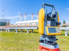
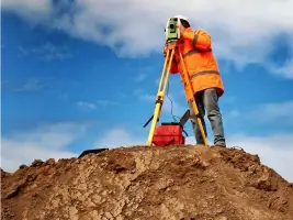
Boundary surveying establishes property lines, resolves disputes, and identifies encroachments. Our team uses advanced technology to locate fences, determine setbacks, and prepare legal descriptions. This service ensures compliance with local regulations and provides accurate documentation for real estate transactions or development projects.
Topographic Surveying
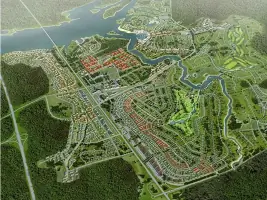
Topographic surveys create detailed elevation models for architects and engineers. We collect terrain data using GPS and electronic instruments to support land development plans. This service provides critical information for infrastructure design, drainage analysis, and environmental impact assessments across Southern California.
Aerial Mapping
Aerial mapping combines drone technology with ground control points to produce high-resolution maps. This service supports large-scale land assessments, construction monitoring, and environmental studies. Our precision mapping solutions reduce field time while maintaining survey-grade accuracy for complex projects.
Land Division
Land division services facilitate parcel splits through tract maps, lot line adjustments, and merger documentation. We handle all regulatory requirements for local government approvals. This service enables property owners to optimize land use while ensuring compliance with zoning and subdivision standards.
GPS Surveying
GPS surveying provides precise horizontal and vertical control for construction and mapping projects. Our equipment captures real-time data for boundary verification and infrastructure layout. This service improves efficiency in large-area surveys while maintaining compatibility with CAD and GIS systems for seamless project integration.
People
Ray Lombera
Founder & Principal Surveyor
Ray Lombera founded the firm in 2001 with expertise in boundary analysis and land development. He oversees project quality control and client communication, leveraging 23 years of experience in Southern California's geospatial challenges. His leadership ensures technical excellence and regulatory compliance.
Questions
What surveying services do you specialize in?
We specialize in boundary surveys, topographic mapping, GPS surveying, land division, aerial mapping, and legal description preparation for Southern California clients.
Do you serve areas outside Glendale?
Yes, we serve all of Southern California including Los Angeles, Orange, Riverside, and San Bernardino counties for land development projects.
What technology do you use?
We employ GPS systems, electronic data collectors, drones, and CAD software to ensure precision and efficiency in all surveying projects.
Are your services available for public agencies?
Yes, we work with municipalities and public agencies on infrastructure projects, right-of-way surveys, and regulatory compliance mapping.
How do you handle complex boundary disputes?
Our team conducts thorough record research, field analysis, and legal documentation to resolve disputes while maintaining court-admissible standards.