Business Details
11 Years
experience
Precision Land Surveying Services in Oregon
Wild Rivers Surveying is a full-service land surveying firm dedicated to delivering precise and reliable solutions across Oregon. Established in 2015 and based in the Rogue Valley, we combine over 25 years of professional expertise with advanced technology to serve private developers, homeowners, construction contractors, and government agencies. Our founder, Aron Cutsforth, PLS, graduated from Oregon Institute of Technology's Surveying program in 2001 and has built a career focused on accuracy, client communication, and project follow-through. We specialize in topographic mapping, boundary surveys, construction staking, and 3D machine control models, ensuring every project meets exacting standards. Our commitment to elevated service extends through geodetic control networks and as-built documentation, supporting infrastructure development from initial design to final implementation.With experience spanning local, state, and federal projects, we provide tailored surveying solutions that address unique site challenges. Our approach integrates GPS technology and digital modeling to deliver actionable data for construction, utility design, and land development. By maintaining rigorous quality controls and prioritizing client collaboration, we ensure survey results that align with regulatory requirements and project goals. This dedication to precision and professionalism has established us as a trusted partner for surveying needs throughout Oregon.
Services
Topographic Mapping
As-Built Surveys
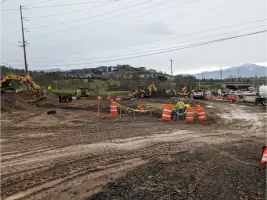
Construction Staking
Control Networks
3D Machine Control
Boundary Surveys
Details
- Year established: 2015
Highlights and features
- 25 years of Oregon-specific surveying expertise
- Advanced GPS and 3D modeling technology integration
- Comprehensive services from boundary surveys to machine control
- Licensed Professional Land Surveyor ownership
- Proven track record with government and private projects
Services
Topographic Mapping
Our topographic surveys create detailed representations of natural and man-made features for construction planning. Using advanced GPS technology, we capture elevation data and physical characteristics to support grading, drainage, and utility design. This critical information helps engineers and developers make informed decisions about land development projects.
Construction Staking
We establish precise reference points and markers to guide construction projects accurately. Our staking services ensure proper placement of buildings, roads, and infrastructure according to design specifications. By maintaining strict tolerances, we help prevent costly rework and ensure compliance with project plans and local regulations.
3D Machine Control
Our 3D machine control models enable automated grading with construction equipment. These digital representations allow excavators and graders to achieve exact elevations without constant manual verification. This technology improves efficiency, reduces material waste, and ensures accurate site preparation for complex infrastructure projects.
Boundary Surveys
We determine exact property boundaries through comprehensive title research and field measurements. Our boundary surveys identify legal ownership limits by analyzing historical deeds and physical markers. This service protects property rights, resolves disputes, and provides essential documentation for real estate transactions and development projects.
Control Networks
We establish geodetic control networks using GPS technology to create accurate spatial frameworks. These reference systems provide consistent positioning data across large project areas through strategically placed control stations. This foundational work ensures measurement consistency and supports long-term monitoring for infrastructure and land development projects.
People
Aron Cutsforth
Owner/Operator
Licensed Professional Land Surveyor with 25 years of Oregon surveying experience. Graduate of Oregon Tech's Surveying program, specializing in construction staking, boundary determination, and digital modeling. Leads all projects with emphasis on accuracy and client communication.
Questions
What areas do you serve?
We provide surveying services throughout the entire State of Oregon, with primary operations based in the Rogue Valley region.
What surveying technologies do you use?
Our equipment includes GPS systems for control networks, total stations for boundary surveys, and 3D machine control models for construction projects.
How experienced is your team?
Our owner-operator has 25 years of professional surveying experience in Oregon, working with both private and government clients since 2001.
What project types do you handle?
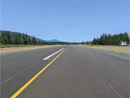
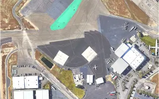
We work on residential, commercial, and government projects including roads, utilities, airports, and land development throughout Oregon.
How do you ensure survey accuracy?
We combine field measurements with digital modeling and maintain rigorous quality checks throughout each project lifecycle.