Business Details
50+ Years
experience
Professional Surveying Services in Honolulu, Hawaii
Walter P Thompson, Inc. has been a trusted leader in surveying and mapping since 1950, delivering precision and expertise to clients across Hawaii. Founded by Walter P Thompson and now led by his son, James R. Thompson, LPLS, our firm combines decades of experience with cutting-edge technology to meet evolving industry demands. Our team specializes in boundary surveys, ALTA/NSPS land title surveys, 3D laser scanning, topographic mapping, and construction layout services tailored to residential, commercial, and governmental projects. We maintain rigorous adherence to state and federal standards while prioritizing client collaboration, ensuring accurate results for complex land development, legal documentation, and infrastructure initiatives.With over 70 years of local expertise, we serve Honolulu and all Hawaiian Islands, handling everything from shoreline certifications to volumetric measurements for mining operations. Our commitment to excellence extends to education, as our leadership has taught surveying techniques at Honolulu Community College and contributed to industry conferences. We operate from our second-floor office at 1724 Hart Street, Honolulu, maintaining transparent communication through direct appointments and 24/7 contact options. Our reputation for reliability is built on generations of disciplined work ethic, technical innovation, and personalized service for every client engagement.
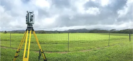

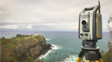
Services
Boundary Surveys
ALTA/NSPS Surveys
3D Laser Scanning
Topographic Surveys
Construction Surveys
Shoreline Certification
Flood Elevation Certification
Volumetric Surveys
Mapping Services
Details
- Year established: 1950
Highlights and features
- We offer 70+ years of Hawaii-specific surveying expertise since 1950
- Our family leadership includes James R. Thompson, LPLS with 40+ years of local experience
- We utilize advanced 3D laser scanning and digital mapping technologies
- We handle complex projects from shoreline certifications to mining operations
- Our team provides ALTA/NSPS land title surveys meeting national standards
Services
Boundary Surveys
We conduct precise boundary surveys for residential and commercial properties, including K-2 and K-1 surveys required by Hawaii real estate contracts. Our team handles legal documentation needs, property line determinations, and land dispute resolutions across urban and rural environments. With expertise in state-specific requirements, we provide accurate measurements for property transfers and development projects.
ALTA/NSPS Surveys
Our ALTA/NSPS land title surveys meet national standards for commercial property transactions. We deliver detailed mapping that includes easements, rights-of-way, and improvements, following minimum standard detail requirements. These surveys are essential for title insurance purposes and major real estate deals across all Hawaiian islands.
3D Laser Scanning
We provide high-resolution 3D laser scanning services for construction projects and as-built documentation. Our point cloud data captures precise spatial measurements for design planning and structural analysis. This technology supports complex projects requiring millimeter-level accuracy for both interior and exterior environments.
Topographic Surveys
Our topographic surveys document natural and man-made features across diverse terrains, from flat coral fields to mountainous jungle areas. We create detailed elevation models for land development, environmental assessments, and infrastructure planning. This data supports construction projects and environmental compliance requirements.
Shoreline Certification
We perform official shoreline certifications through collaboration with Hawaii state agencies and coastal experts. Our process documents and records certified shorelines for regulatory compliance, requiring 3-6 months to complete. These surveys are critical for coastal property development and environmental protection requirements.
People
James R. Thompson
President
LPLS-certified leader with 40+ years of Hawaii surveying experience. Succeeded his father in 1976 after working as a rodman during summers. Holds land court license since 1977 and has testified in court proceedings. Former instructor at Honolulu Community College and active member of professional surveying organizations.
David M. Thompson
President
Current co-president maintaining family leadership tradition. Works alongside James Thompson to continue the firm's commitment to technical excellence and client service. Shares responsibility for strategic direction and operational oversight of surveying projects across Hawaii.
John R. K. Akina
Vice President
Licensed Professional Land Surveyor serving as vice president. Contributes technical expertise and management experience to support complex surveying projects. Collaborates with senior leadership to maintain quality standards and client satisfaction across all service offerings.
Jeffrey R. Lucas
Senior Draftsman
Experienced senior draftsman responsible for creating detailed survey drawings and technical documentation. Applies specialized knowledge of surveying standards to produce accurate plans for boundary determinations, construction projects, and legal records.
Shannon K. Wright
Construction Project Manager
Manages construction surveying projects from initial layout to final certifications. Coordinates field operations and client communications for infrastructure developments. Ensures precise implementation of survey data throughout construction phases.
Questions
What types of surveying services do you offer?
We provide boundary surveys, ALTA/NSPS land title surveys, 3D laser scanning, topographic mapping, construction layout, shoreline certification, and flood elevation certification services across Hawaii.
How long have you been in business?
Walter P. Thompson, Inc. has provided surveying services since 1950, celebrating over 70 years of continuous operation in Honolulu and the Hawaiian Islands.
Do you serve areas outside Honolulu?
Yes, we serve all Hawaiian Islands including Oahu, Maui, Big Island, and Kauai, handling surveying projects from Waikiki to remote locations across the archipelago.
What makes your firm different from other surveyors?
Our combination of generational expertise, family leadership since 1950, and investment in advanced technologies like 3D laser scanning provides unique value for Hawaii-specific surveying challenges.
How do I request a survey?
Contact us through our website or call (808) 536-2705 to discuss your project. We'll assign a team member to assess your needs and provide a customized solution.
What's your shoreline certification process?
Our shoreline certification process involves collaboration with state agencies and typically takes 3-6 months. We handle documentation from initial measurements to final official recordings.