Ag Geospatial NW, LLC provides Land Surveying and GIS to support rural properties, Farms and Ranches in the Northern Willamette Valley. I am a Surveyor with 27+ years' experience in all types of Land Surveying services. Boundary Surveys, Property Line Adjustments, Partitions, Measure 49, Construction staking, FEMA Elevation Certificates and more. Supporting Precision Ag by helping setup, populate, organize and maintain Farming Ag database of land facts. Creation of Farm and Ranch Mapbooks for overview of lands in use by location, reference name, address for safety measures and more.
I began my surveying career in 1987 working for CH2M HILL in Portland Oregon. I started out as a rod person and have over the years worked up through the different levels to managing the Land Surveying group. I oversaw a group of 9 surveyors that were able to work on many large, exciting projects in Oregon, the Northwest, across the United States and even some International projects using some of the latest surveying tools. We were a small group that gotexposure to large projects and the latest technologies.
We have been blessed to have an extensive portfolio of Land Surveying experiences. We are a Land Surveyor firm based out of Molalla, Oregon. Serving communities like Molalla, Colton, Canby, Aurora, Hubbard, Donald, St Paul, Woodburn, Yoder, Monitor, Mt Angel, Silverton, Gervais, Brooks, Clackamas County, Marion County, Yamhill County, Polk County and more in the North Willamette Valley. We have an extensive portfolio of 29+ years of Land Surveying experiences. This has included boundary resolution for residential, farms, commercial, roads and more; Boundary Line Agreemenets (BLA), Property Line Adjustments (PLA), Partitions, Measure 49, FEMA Elevation Certificates, FEMA LOMA and more.
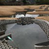
Drone flight of onion harvesting today!
Similar Businesses