Business Details
49 Years
experience
Your Trusted Surveyors for Aerial Mapping in San Luis Obispo
Central Coast Aerial Mapping has been a leader in photogrammetric mapping for over three decades. Founded in 1977, our company combines generational expertise with cutting-edge technology to deliver precise aerial mapping solutions. Our team specializes in 3D stereo digital softcopy workstations, drone imagery vectorization, and high-resolution scanning. We hold certifications from the American Society for Photogrammetry and Remote Sensing and comply with national mapping standards. With in-house analytical bridging capabilities, we produce topographic maps, digital orthophotos, and terrain models tailored to engineering programs. Our work spans Northern California to San Diego, serving state and local agencies.Under the leadership of ASPRS-certified photogrammetrist Robert Lafica, we maintain a legacy of innovation. Our technicians utilize the UltraCam X Digital Camera and advanced LIDAR systems to ensure unmatched accuracy. We adhere to CALTRANS qualifications for 3D digital mapping and remote sensing. Our commitment to quality is rooted in a 30-year history of adapting to technological advancements while preserving traditional surveying excellence. From initial aerial triangulation to final surface models, we deliver data-driven solutions for infrastructure, environmental, and urban planning projects.
Services
UAV Drone Mapping
Photogrammetric Mapping
Digital Orthophotos
Digital Terrain Models
Hi-Res Scanning
Surface Models
Analytical Bridging
Topographic Maps
Aerial Triangulation
LIDAR Mapping
Details
- Year established: 1977
Highlights and features
- We have over 30 years of photogrammetry experience with three generations of mapping expertise
- Our ASPRS-certified photogrammetrists ensure compliance with national mapping standards
- We utilize cutting-edge 3D stereo digital softcopy workstations and UltraCam X technology
- In-house analytical bridging and mapping capabilities streamline project workflows
- Proven track record with state and local agencies including LA County Transportation Commission
Associations and certifications
- American Society for Photogrammetry and Remote Sensing (ASPRS)
- California Department of Transportation (CALTRANS)
Services
UAV Drone Mapping
Our UAV drone mapping service creates 3D stereo line work using photogrammetry. We process drone imagery to produce survey-grade topographic data with sub-centimeter accuracy. This technology enables efficient mapping of complex terrain and infrastructure projects while maintaining compliance with ASPRS standards.
Digital Orthophotos
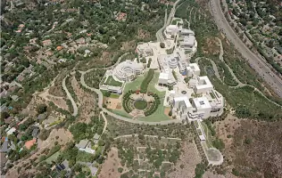
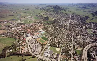
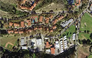
We convert vertical aerial photographs into digital orthophotos that combine map accuracy with photographic detail. Our process corrects distortions to create true-to-scale images suitable for land use planning, environmental monitoring, and engineering projects requiring precise spatial measurements.
Photogrammetric Mapping
Specializing in photogrammetric mapping, we create detailed topographic representations using stereo imagery analysis. Our methods produce accurate elevation models and feature extraction for applications including floodplain mapping, transportation planning, and mining operations across California.
Hi-Res Scanning
Our RM-6 photogrammetric scanner digitizes roll film and individual frames with automated advancement. This service preserves historical aerial data while enabling modern analysis through integration with digital mapping systems and GIS platforms.
Surface Models
We generate triangular mesh surface models optimized for computer visualization. These models support infrastructure design, volumetric calculations, and terrain analysis while maintaining compatibility with engineering software like AutoCAD and MicroStation.
People
Robert Lafica
Supervisor & Certified Photogrammetrist
ASPRS-certified photogrammetrist with 25+ years of experience leading aerial mapping projects. Specializes in integrating new technologies while maintaining survey accuracy standards. Manages projects for state transportation agencies and municipal clients.
Questions
What geographic areas do you serve?
We provide mapping services from Northern California through Central California to San Diego County.
What mapping technologies do you use?
We utilize UAV drones, 3D stereo softcopy workstations, UltraCam X digital cameras, and LIDAR systems for precise geospatial data collection.
Are your photogrammetrists certified?
Yes, our team includes ASPRS-certified photogrammetrists who maintain compliance with national mapping standards.
What deliverables do you provide?
We deliver topographic maps, digital orthophotos, terrain models, surface models, and analytical bridging data compatible with engineering software.
How long have you been in business?
We've provided photogrammetric mapping services since 1977, with three generations of mapping expertise.